Phoenix Reborn: Reorganizing Downtown Pontiac’s Bus Service
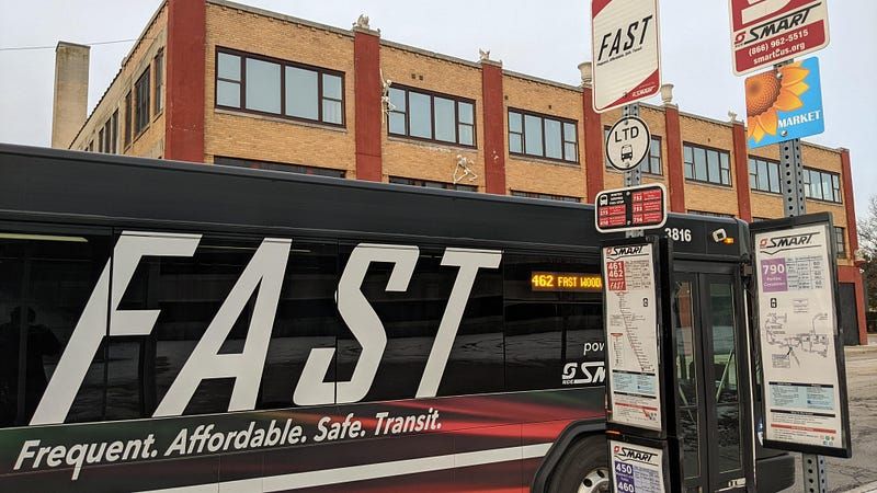
A FAST Woodward bus pulling into the Phoenix Center bus stop on January 14th.
Update, July 2023
Oakland County has finalized plans to purchase the Phoenix Center complex, including Ottawa Towers, and redevelop it into a public downtown campus. This has the potential to drastically elevate levels of foot traffic in the area and restore the Phoenix Center site as downtown Pontiac’s anchor.
Additionally, note that this is a retrospective on an issue from last summer. There is currently no imminent plan to close the Phoenix Center.
This news effectively nullifies what I made a case for in this article, but consider it a study in the importance of planning a bus stop’s location.
TL;DR
The best approach to improving service is the simplest: Move the bus shelters from the Phoenix Center three blocks north to Saginaw and Huron while keeping the existing connections between routes intact at the new location. Read on if you want to understand why.
Standard disclaimers: I wasn’t paid to write this article, views are my own, etc etc. You know the drill.
What's Going On?
Over the past five years I’ve been a frequent flyer at the Phoenix Center bus stop in Pontiac, a city in Metro Detroit at the north end of Woodward Avenue. It’s the most direct access point to FAST Woodward, one of our express bus lines, from the local bus route that runs closest to where I live near Oakland University. See my previous write-up on that topic .
SMART , Metro Detroit’s suburban transit provider, published its regularly scheduled quarterly service update earlier this summer. Per the plans, the Phoenix Center would be temporarily replaced with five separate stops located throughout downtown Pontiac. This generated some buzz — enough so to delay the change to September while further discussions take place. So, what’s going on?
First off, let’s get our story straight: This is a planned service adjustment, not a service reduction. No routes or runs are being eliminated. The service hours for each route remain unchanged. Under this plan Pontiac would still be served by the same five routes as usual, just at different locations. Keep that in mind if local media continues to report on these “service cuts.”
With that out of the way, we can still do better than the current plan. Let’s dive into the details.
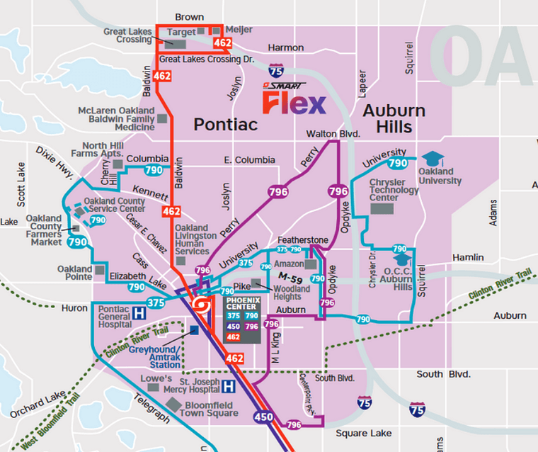
The current transit network in the Pontiac and Auburn Hills area. Five routes converge in downtown Pontiac at the Phoenix Center. (Source: SMART)
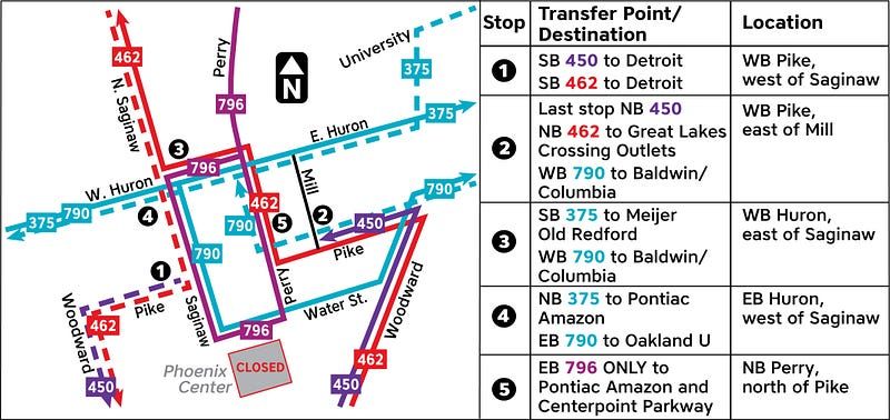
The official detour map for the five new temporary stops in downtown Pontiac. (Source: SMART )
Why changes are needed, and how to do them right
Bus riders making a connection in downtown Pontiac were intentionally separated from the rest of the area’s foot traffic. We have an opportunity to correct this mistake.
The Phoenix Center is a parking garage with an elevated green space and amphitheater constructed in the 1980s at the south end of downtown. The site is no longer an active venue and currently functions only as legally required parking for Ottawa Towers, the office buildings on the east and west sides of the center.
While various efforts have attempted to revitalize the structure in recent years, in its current state it sees little to no foot traffic on a typical day. All of downtown’s businesses are blocks away, mainly along Saginaw Street north of Pike.
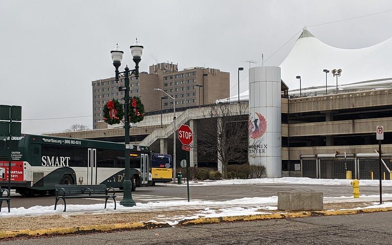
Four local routes and FAST Woodward serve the Phoenix Center.
SMART based their redesigned plan around improving “safety, access, and reliability,” all of which have been concerns voiced by riders at this stop over the years.
June 22, 2022 • 3:45 amWe’re postponing closure of Phoenix Center bus stop until at least Sept to allow more public discussion of changes, issues & impacts. Closure was based on input & comments over several years - safety, access & reliability for riders & residents will continue to guide decisions.
But here’s the thing: All of these issues are a function of the stop’s location, not the people waiting there.
Let’s take these one at a time.
Improving safety
The Phoenix Center isn’t a pretty bus stop. Quite the opposite, if we’re being honest. And before anyone says “but people use it and need it, you can’t say that” — of course people do! I use it too! But that doesn’t mean we should ignore a critical piece of infrastructure being unsightly, because that leads to riders feeling unsafe. A decision to split this stop into five would seemingly imply that its issues stem from bus riders waiting in a single large group. But they don’t — the environment is the problem.
You don’t feel welcome when you’re waiting for a bus at the Phoenix Center. You feel like you were kicked into a shadowy corner because nobody wanted to see you on foot in the city. It’s two shelters in front of a huge, disused concrete staircase with no lighting underneath, and when you’re sitting in those shelters you’re looking right at the dumpsters in the alleyway between Pike and Perry.
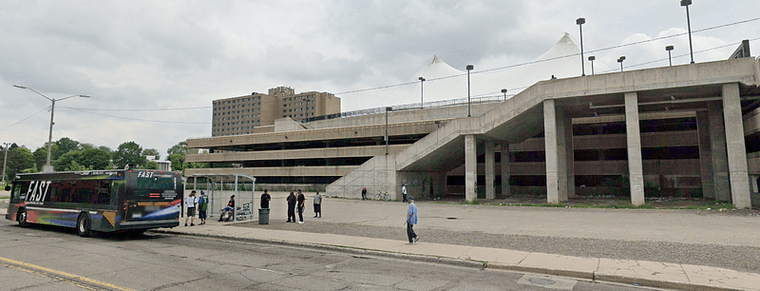
That slab of concrete used to be a grassy plaza back when the Phoenix Center was in use. Do you think any of these riders actually want to stand here waiting for a connection? (Source: Street View)
For safety in a city, you need eyes on the street. Someone is much less likely to cause a problem if they’re being watched by shoppers, business owners, residents on front porches — whoever. Moving the stop to a visible area would be more effective than splitting up riders across random street corners.
Improving access
The planned redesign would address safety by moving the location, but the implementation of the redesign fails to improve access by failing to preserve the Phoenix Center’s strength: The connections it provides to riders.

The Phoenix Center is displayed prominently on the official FAST Woodward guidemap as a critical transfer point between the express line and local routes. (Source: SMART )
The Phoenix Center is what SMART refers to as a “Major Transit Hub” on the system map. It’s up there with the Royal Oak Transit Center, SMART’s only brick-and-mortar “station” with full customer service, and the State Fairgrounds on Woodward. The Phoenix Center is the only location where riders in the Pontiac area can transfer between every route that serves the city at a single point.
The function of this bus stop is more important than its location. As long as the single transfer point is preserved, it can be moved to any visible area downtown.
Improving reliability
In the transit-planning world, it’s important to understand a simple fact: People naturally want to travel in straight lines. Bus routes that offer a direct connection between two busy areas (or “trip generators” in planning parlance) perform best. But we don’t live on a perfect grid, so you often have to introduce “deviations” into routes: Several minutes of winding twists and turns to reach locations that aren’t on a straight-line path between two anchor points. Think malls, college campuses, and other destinations with large parking lots and long access roads.
Let’s focus in on the segment of Route 375 which runs between Telegraph / Huron and Amazon’s distribution center at the former Silverdome site. If you were driving that, it’s about as close as you can get to a straight line across Pontiac’s street grid. That’s why Huron Street was designated M-59: It’s the main east-west thoroughfare through the city.
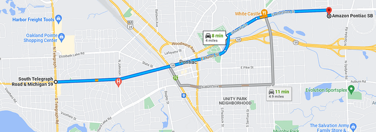
Simple, straightforward, smooth sailing
But on the 375’s current routing, SMART has to deviate to the Phoenix Center to connect to all those other routes. This takes time, and on concert days at the Crofoot it can take a LOT of time or involve a messy detour. When summer events are in full swing, downtown Pontiac quickly becomes congested.

Who punched a hole in the middle of my route? (Screenshot from Transit )
If you look back at the proposed reroute, the 375 stays on Huron. Yay… kind of? Because this comes at the expense of an easy transfer to FAST. Walking along Saginaw from Huron down to Pike takes 3 to 5 minutes which is manageable for many, but if someone’s using a mobility device or has a tight connection they’ll have a bad time with the new configuration.
The Solution: X Marks the Spot
So, we need to move the Phoenix Center transfer point to somewhere that’s visible, near businesses, and minimizes route deviations as much as possible. To better explore this I’ve redrawn the official detour diagram as simplified, Metro-style transfer map.
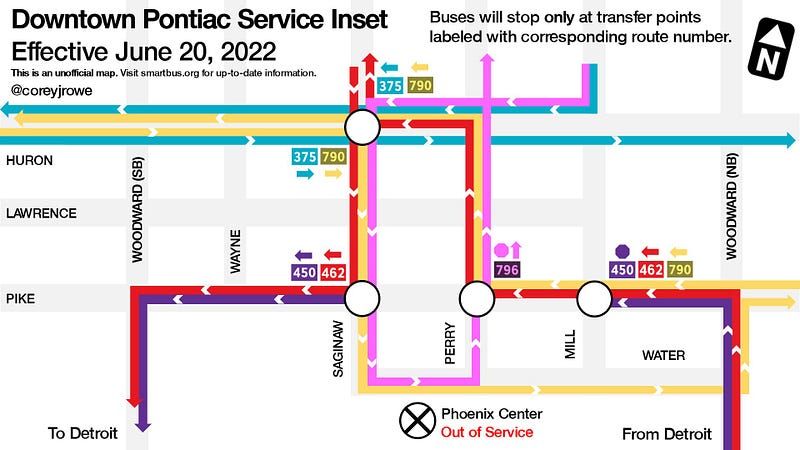
This definitely wasn’t created in PowerPoint with tables and text boxes at 1am.
The answer looks pretty clear now, doesn’t it? Huron and Saginaw is the spot to pick (and you can keep the new temporary stops in service along some of the routes too). In the redesign, four out of the five routes pass through this intersection already. Route 450, the Woodward local, does currently, so all five routes are capable of doing so.
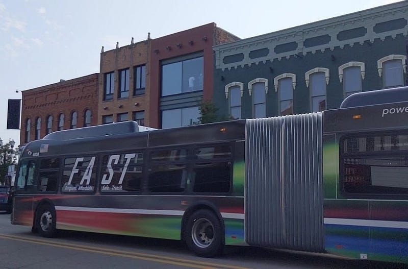
FAST Woodward already travels straight down Saginaw between Huron and Pike. It just doesn’t stop.
Here’s what service could look like with Huron and Saginaw employed as our new Pontiac transfer point (with added service to the Amtrak station sprinkled in for good measure).
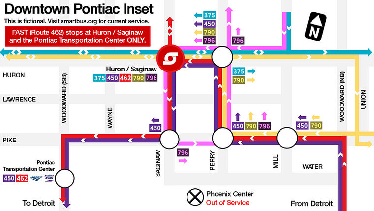
Cartographic design is my passion
Looks nice, yeah? Saginaw and Huron is right next to a courthouse and a short walk from Liberty Bar, one of Pontiac’s busiest late-night venues. If you head out there, you’ll notice that the sidewalk on the southwest corner of the intersection is unusually wide and even has a curb bulb-out.
It’s almost as if… this intersection was designed to be a bus stop?
Oh, wait. It WAS.
The Real Challenge: Undoing Past Mistakes
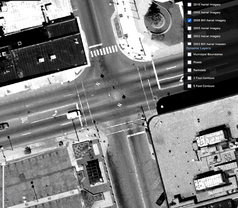
A quick dive into the Oakland County Property Gateway reveals a shelter was in place at the southwest corner of Huron and Saginaw in 2006. According to past system maps, the transfer point was moved to the Phoenix Center within the next year.
The people at SMART are… well, smart. If I can understand all this as a rider and advocate, surely the folks who are paid to design this stuff can as well. And they did — the route configuration in Pontiac 15 years ago was exactly this! Huron and Saginaw was the transfer point as recently as 2006, complete with a shelter.
I’m still searching for solid documentation on the conversations leading to this change between 2005 and 2007, but confirmed through a visit to the Oakland History Center that the shelter was present as this street corner for more than 40 years.
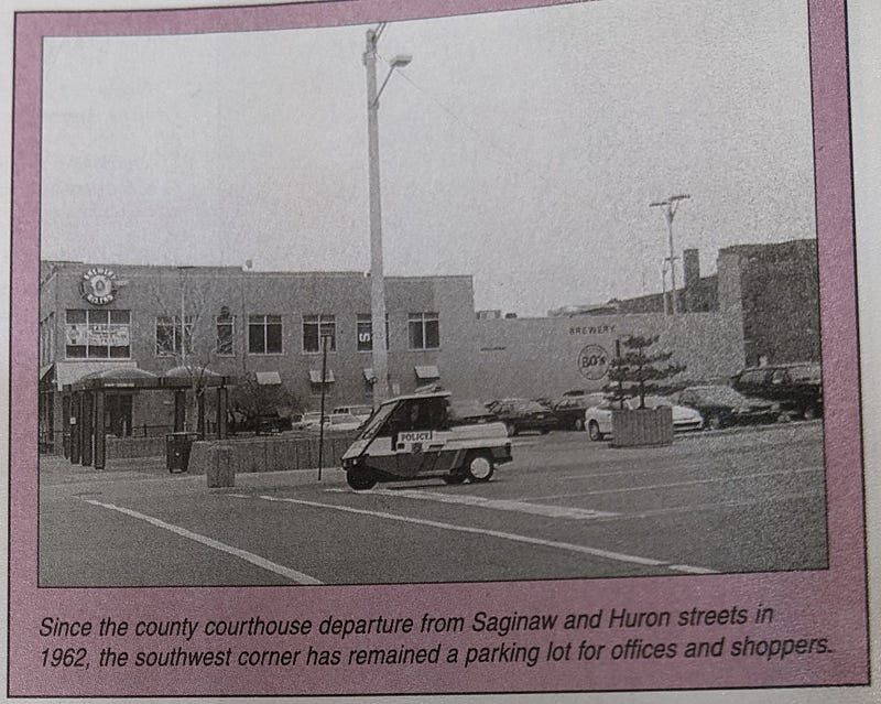
The demolition of the old county courthouse made space for the well-sited shelter. (Source: Greater Pontiac Area Chamber of Commerce, June 1999, In Print)
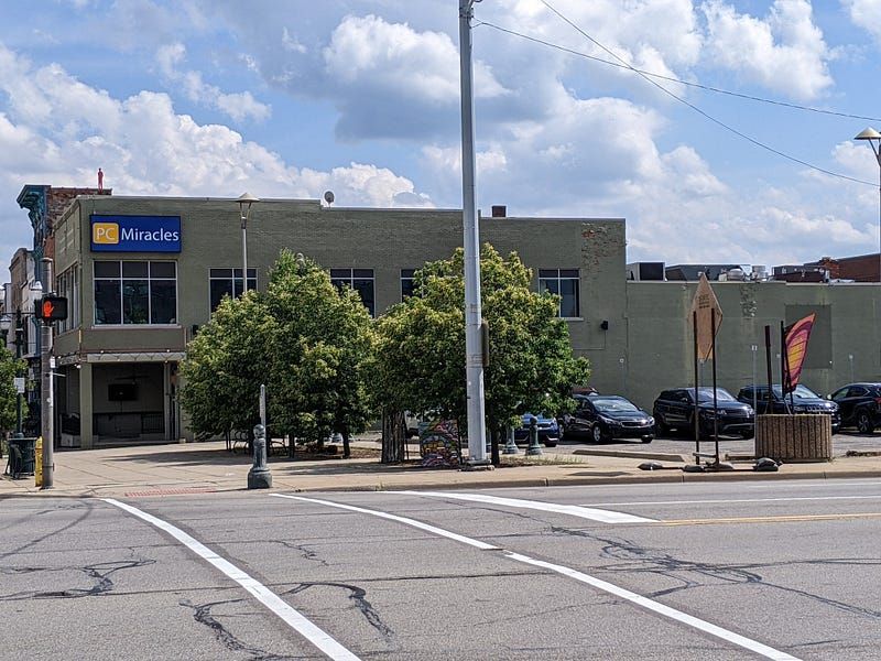
The same location today.
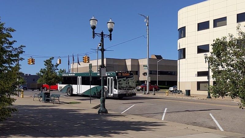
A Telegraph bus passing the same location at Huron and Saginaw.
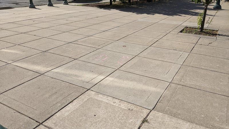
There’s more than enough room to reinstall a shelter here.
Times have changed; we now understand that the healthiest cities prioritize people, not cars. MDOT recently committed to deconstructing the harmful Woodward Loop , which currently cuts off downtown from the rest of the city and prioritizes Pontiac as a place to travel through rather than a place to travel to. We have city and county leadership that values transit riders and the economic benefits a properly designed bus system brings to a community. Now that Pontiac’s bus service is in the spotlight, we have a golden opportunity to undo the damage of years past once and for all.
Let’s get to it.
 smartmovesus