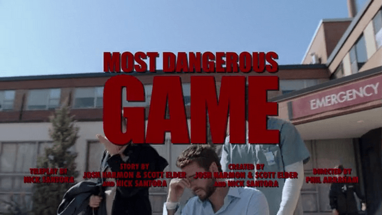
An Exploration of Filming Locations in “Most Dangerous Game”
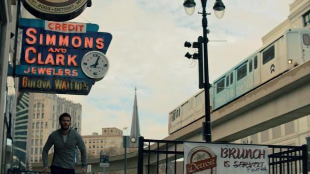
Source: Quibi (website has been taken down)
2023 Update
Hey folks. Future Corey here. So, Quibi kinda died as soon as it became a thing . Roku took over all of its original content, but pulled this show from its platform in September . Season One is now available on Amazon Prime in movie format, while Season Two (which this article does not cover) is no longer available on any streaming platform.
All of the screenshots in this article were pulled from an Android emulator as that was the only way to capture frames at the time of Season One's initial release on Quibi in April 2020.
Onward!
Before we dive in...
Please note that the television show covered by this article is intended for mature audiences due to language / violence. Reader discretion advised.
Also, Spoiler Warning: I’m delving into the filming locations for each episode, so naturally this will contain spoilers for the entirety of Season One.
Additional disclaimer: I am not affiliated with nor speaking on behalf of the producers of Most Dangerous Game or any businesses, locations, or services mentioned in this analysis, or Quibi , the streaming platform which hosts the show. I’m just a Metro Detroit resident with time on his hands due to current events who thought it would be fun to write about a show set in his city.
Most Dangerous Game is directed by Phil Abraham and produced by Blackjack Films, Mayhem Pictures, Silver Reel, and CBS Television Studios.
Setting the Scene
Last November, Liam Hemsworth was spotted filming inside the Renaissance Center downtown for Most Dangerous Game, a short series very loosely based upon the book of the same name. The premise is straightforward: Hemsworth’s character must survive a 24-hour pursuit by skilled “hunters” within the city limits of Detroit .
Hemsworth spotted filming in GM World on the lower level of the Renaissance Center. The show premiered on April 6th and ran for 15 short episodes for a complete runtime of a little over two hours.
My hot take: While the show puts spectacle and cinematography before stellar writing, it’s a fun watch with decent performances from an A-list cast. But this isn’t a review of the story; this is an investigation into where it was filmed.
The entirety of this show takes place in Detroit, but only portions were filmed here. We knew prior to release that Hemsworth was seen filming in the Toronto area. I was determined to figure out exactly which streets, buildings, and venues were standing in for the Motor City.
Episode 1: The Offer
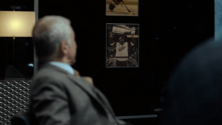
The show begins with Dodge Tynes (Liam Hemsworth) and Miles Sellars (Christoph Waltz) having an intense discussion over the nature of the Game from a cold, dark skyscraper office. Right away, Miles firmly establishes that we’re in Detroit, making reference to a framed picture on the wall of Steve Yzerman hoisting the Stanley Cup.
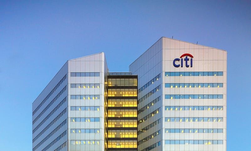
Citigroup Place in downtown Toronto. Source: Oxford Properties
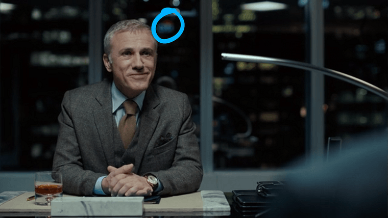
Our first clue as to where we actually are is seen by looking out the window behind Miles’s desk.
In a close-up, the logo on the building directly behind Miles appears to be the Citi logo. Citibank doesn’t have a corporate office in Detroit, but it does have one in Toronto.
The skyline isn’t in focus, so it’s difficult to distinguish other buildings in the shot to orient ourselves.
But then, our characters step onto a balcony to continue their conversation.
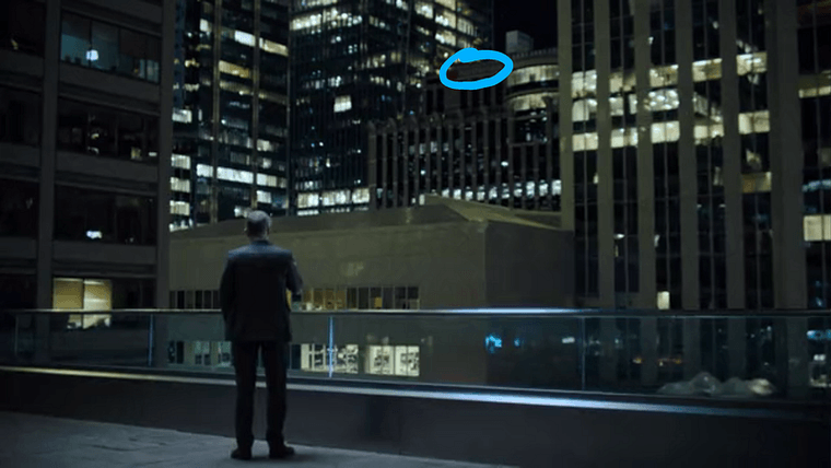
On a large screen, a building name is visible: Northbridge. This is an insurance company headquartered in Toronto, and the short, square building beneath it is distinct enough to pin down the exact location of this balcony.
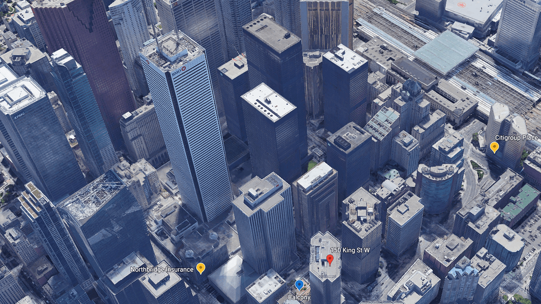
The balcony location in Google Earth.
Bingo. Our skyscraper is 150 King West, with Miles’s evil office somewhere on the south side of the building overlooking University Avenue. The balcony in particular is called the King York Terrace , part of a shared working space.
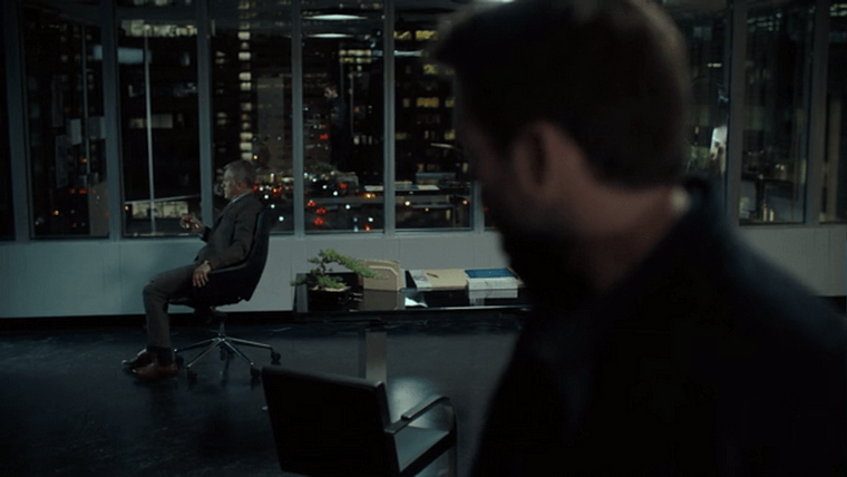
University Avenue as seen from the windows of Miles’s office.
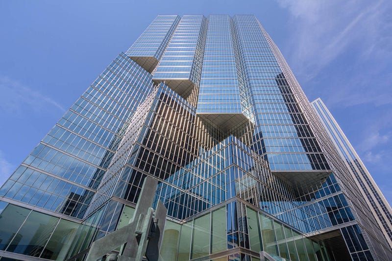
Source: 150 King West
So, downtown Toronto is loaning a few buildings to the Detroit skyline.
Next up is the second episode, where we see our first scenes that were actually shot in downtown Detroit.
Episode 2: The Motivation
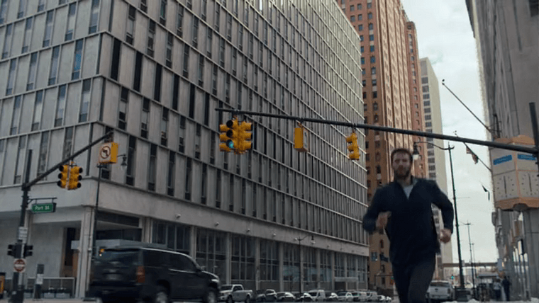
It’s a few days earlier. The episode opens with a few shots of Dodge jogging through downtown.
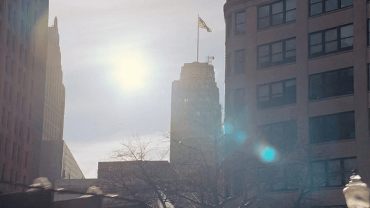
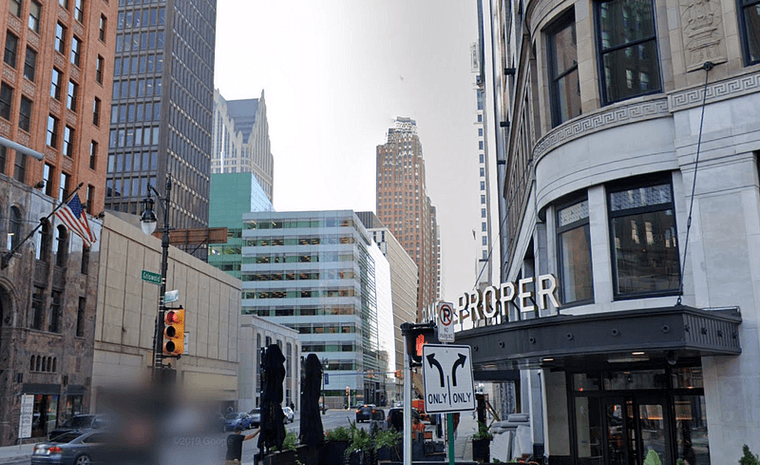
Griswold and State, in front of Prime + Proper (telephoto / zoom lens from a few feet above the street)
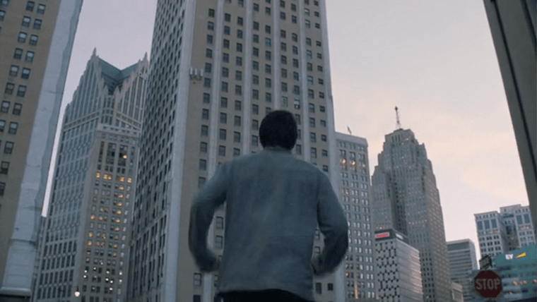
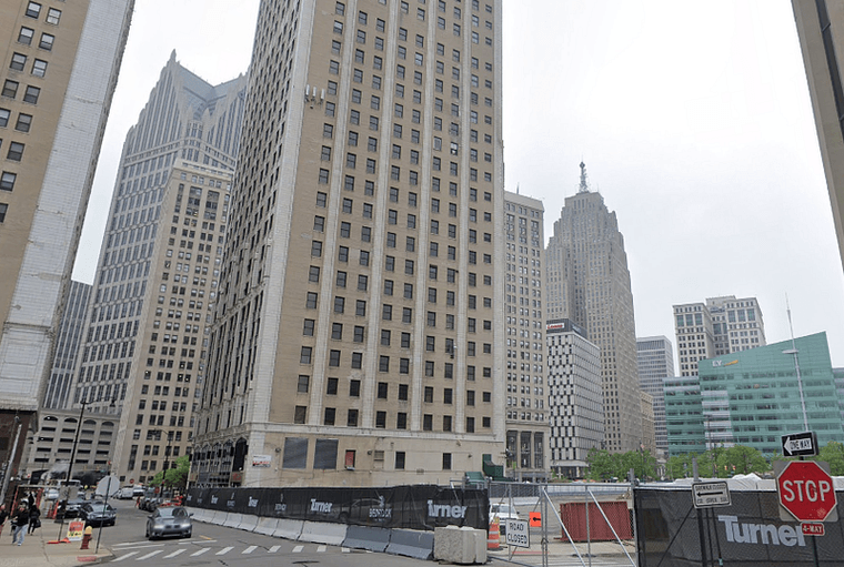
Southwest Bates Street looking towards Campus Martius Park, the center of downtown
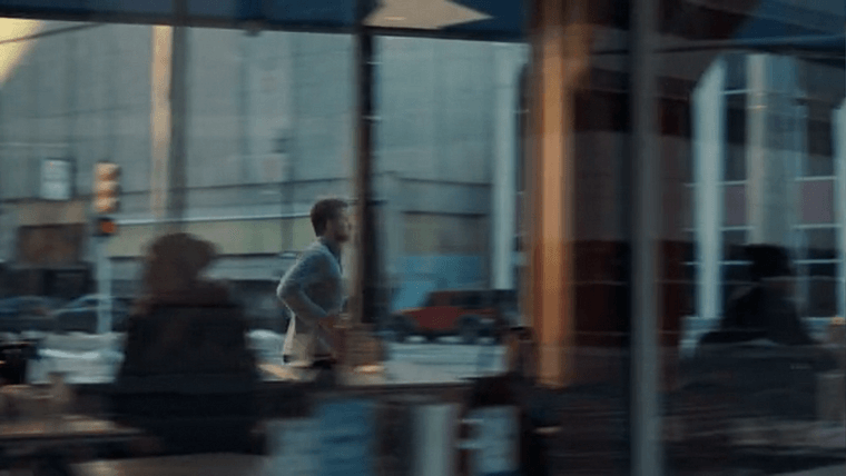
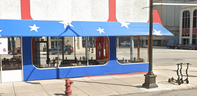
American Coney Island on Lafayette and Griswold
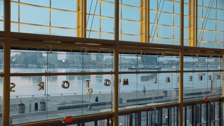
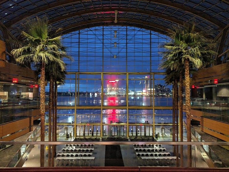
The Riverwalk entrance to the Renaissance Center, General Motors World Headquarters
But then we travel down a Canadian street to reach The Carrington, the fictional building Dodge owns.
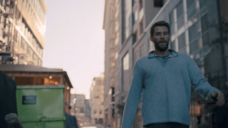
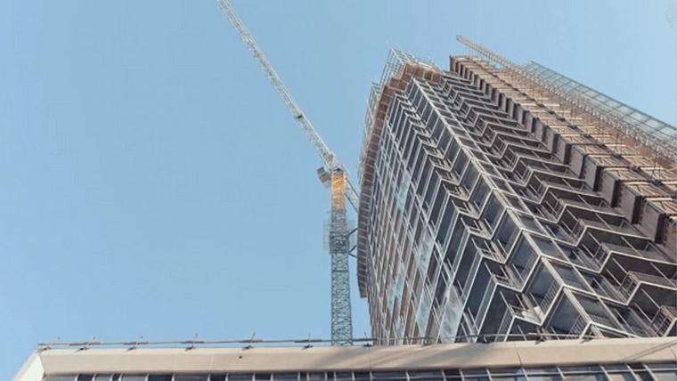
I couldn’t find this building or anything close to it in the Greater Toronto Area. In the episode the building is revealed by a vertical pan on this image, so it’s possible it’s a stock photo or a detailed artistic rendering (this show has the budget for that; we’ll see a lot of chroma keying and CGI in coming episodes).
A small render of how the finished building will look is printed next to the construction entrance, which makes the building being computer generated more plausible.
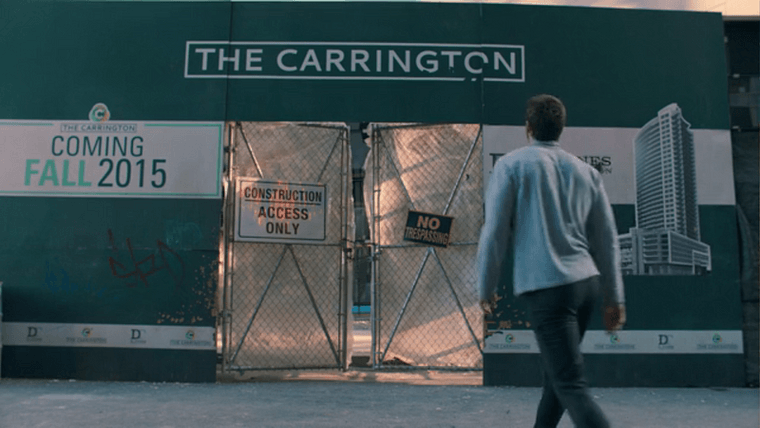
A small render of the completed building is seen to the right. Someone had to design that, which means the entire building was likely drawn up in a computer program.
And speaking of chroma keying: The next shot shows Dodge looking over downtown Detroit from the top of his tower.
Holy green screen.
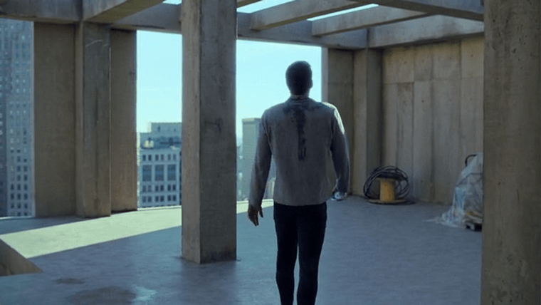
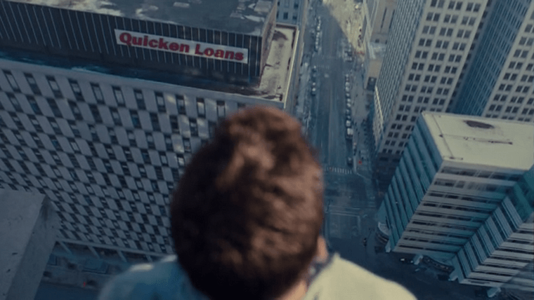
We never see Dodge’s lower half in this shot, and one of the buildings is visibly warped.
So. Where is the Carrington supposed to be? That’s Fort Street looking west. The only building that would offer this vantage point is the First National Building, the 26-story skyscraper at the southeast corner of Campus Martius. The green screen image is likely a panorama taken from the top of that building (or a drone) that was stitched together. Either way, Hemsworth absolutely filmed this shot in Canada and the image of downtown was added in post.
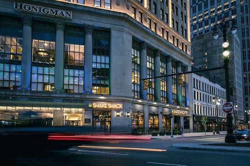
The First National Building. Source: Bedrock Detroit
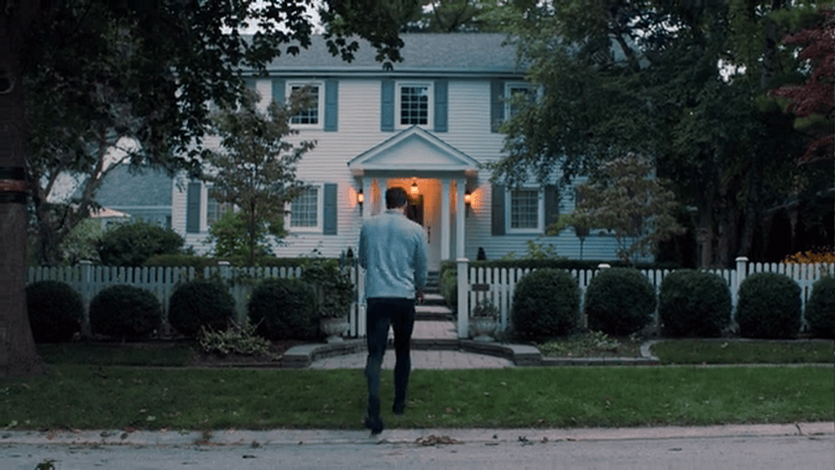
Then he goes home for most of the episode. This house shows up throughout the show and could be anywhere in the Toronto area if not elsewhere, so we’ll disregard it. I’m not that good.
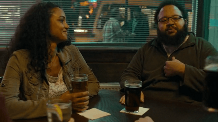
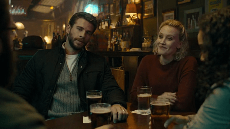
Next up, Dodge meets up with his pals at a bar in the city. A streetcar passes outside the window. That’s a TTC streetcar, so we’re back in Toronto.
Put a pin in this. We’ll find out where this bar is before the series is over.
We’re then introduced to another fictional setting: Van Buren Motors, likely named after the Metro Detroit township of the same name as an Easter egg.
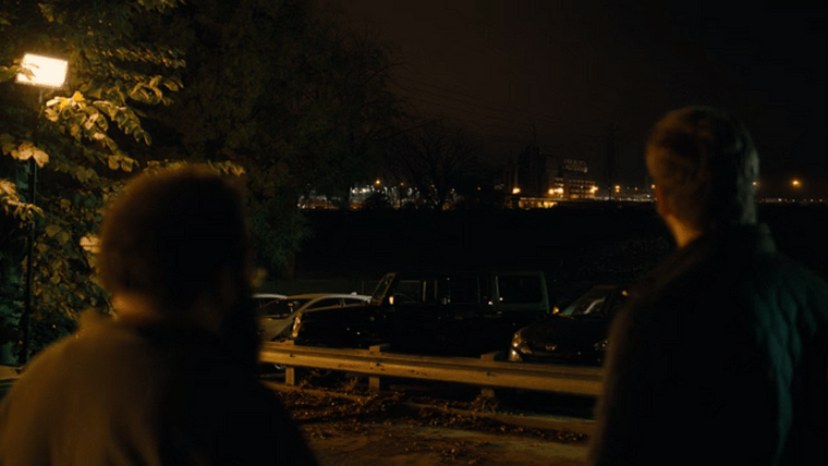
“Look at her. Van Buren Motors. Back in the day, when that sign was all lit up, you could see it from anywhere in the city.” -Looger
We’ll see this car plant close-up later on, but the setting is a nondescript warehouse. The rooftop sign is entirely CG.
Before the episode wraps up we get one more quick shot in the real Detroit. That’s Chase Tower, and Dodge is headed north on Griswold.
In the last minute we see Dodge hop off a city bus, presumably heading to work.
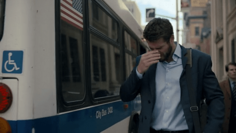
This isn’t a Detroit city bus — we don’t have any buses here with blue stripes. It’s not a downtown Toronto bus either, they’re red and white.
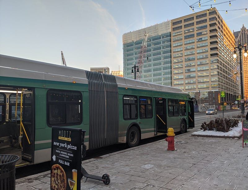
A real DDOT bus on Woodward Avenue, Detroit’s main corridor.
A scene in an upcoming episode makes it clear that this bus was a prop brought on set for filming; the U.S. flag on the back window was added for continuity. Coming up we’ll see a full streetfront which gives away this new, third filming location.
Episode 3: The Rules
We start off this episode in a hospital — “Jefferson Lafayette” hospital, according to the nametags the staff are wearing, with an attending physician visiting from “Sloan Kettering.”
Neither are real hospitals in Michigan, but the names are Easter eggs. Jefferson and Lafayette are streets in Detroit. Sloan-Kettering may be a reference to the New York cancer center; fittingly, Alfred P. Sloan was a former president of General Motors, and Kettering is a public university in Flint, which is about an hour north of Detroit.
Take note of the “EMERGENCY” sign in this shot. Notice how it appears to be covering up a black sign beneath it? This is a building standing in for a hospital.
Also take note of the blocky font on the sign, we’ll see it a lot. The editors used it for almost everything they changed for location continuity.
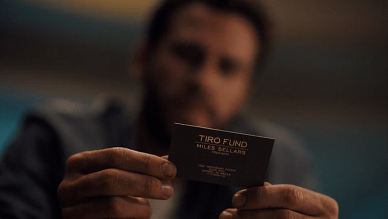
A hospital worker hands Dodge a business card for the Tiro Fund, the company run by Sellars from the first episode. The contact info on the card is listed as 1001 Woodward Avenue Suite 500, Detroit, MI 48226, (313) 555–0132. (We know where Miles’s office really is, though.)
In real life, 1001 Woodward is an office building adjacent to Campus Martius downtown, and Suite 500 is a WeWork. I’ve been up there. And while the phone number is obviously phony because it’s a show, they got the area code right.
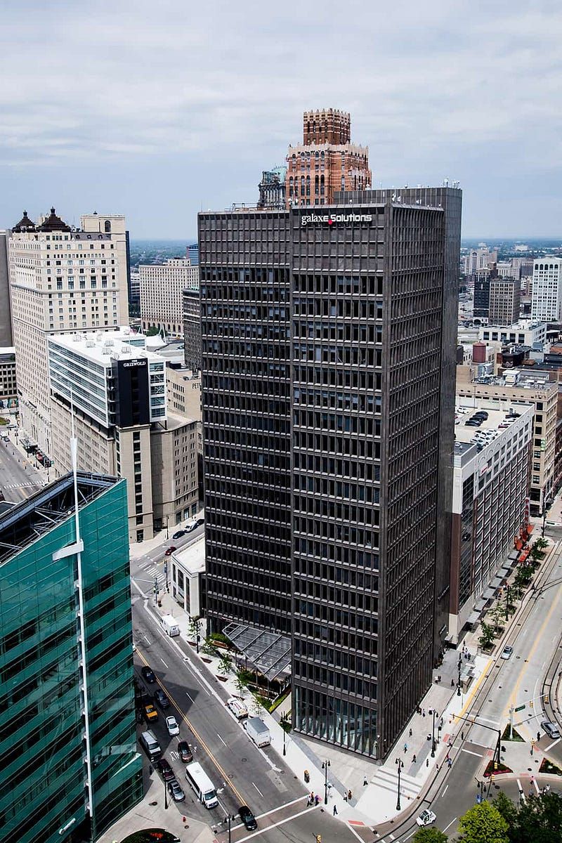
1001 Woodward. Source: Bedrock Detroit
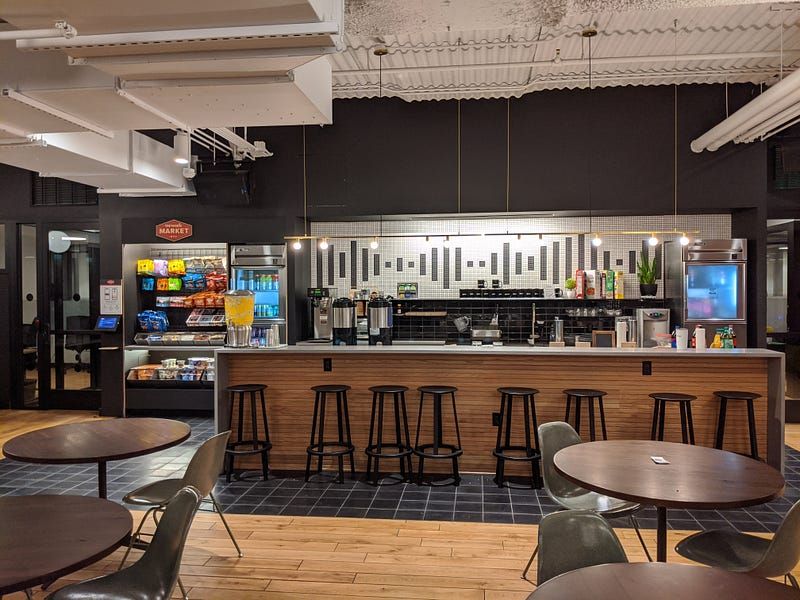
1001 Woodward, Suite 500.
Definitely less evil-looking than Miles’s office. Maybe Miles can offer Dodge a snack before sending him out to be hunted down?
We jump back to the end of Episode 1 and pick up where that conversation left off. The episode ends on King York Terrace with Dodge formally accepting Miles’s offer to participate in the hunt.
Episode 4: The Acceptance
There’s only one new location in this episode, a café where Dodge meets Miles to start the hunt.
We never see the café from the outside or any open windows, so this one is tricky. I don’t recognize it as a restaurant in downtown Detroit, so it’s probably safe to say it’s in the Toronto area.
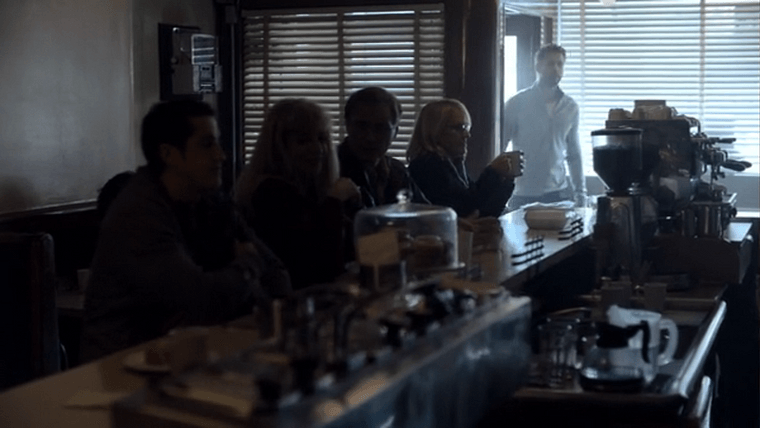
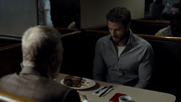
I want that breakfast though.
Episode 5: The Start
Dodge darts out of the café, and now we start some rapid-fire location switching.
After the titles, we cut back to real-life downtown Detroit. Dodge is running south down Griswold at State Avenue (the same location from an earlier shot). The tall brown building to the right is the Stott.
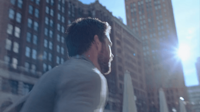
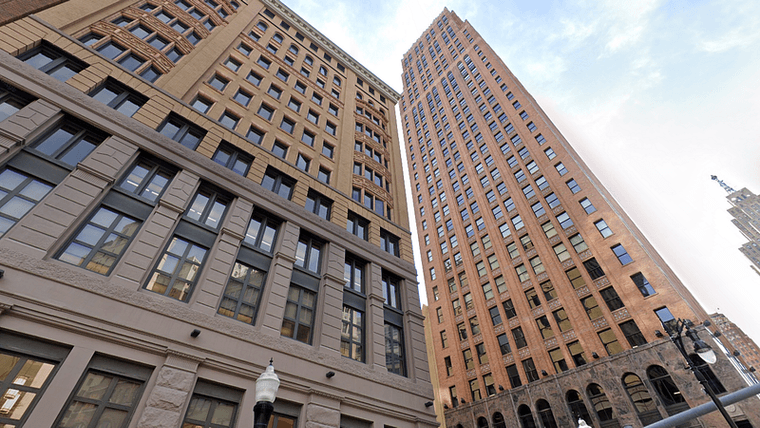
Then we cut to an alleyway off Grand River Avenue, just south of Capitol Park.
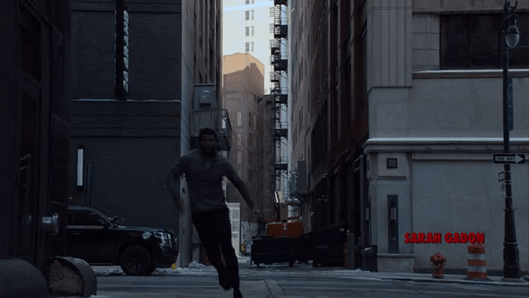
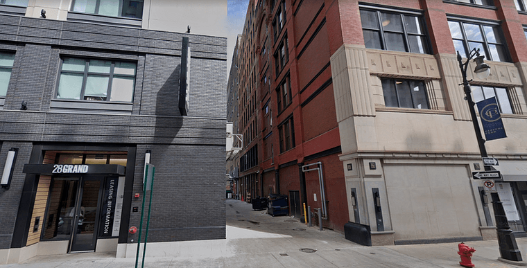
And then, we’re out of the city with what might be the most important shot in this entire writeup:
A clear view of a streetfront.
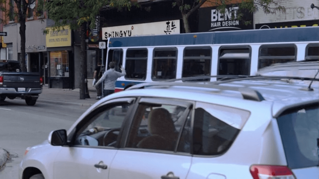
This shot has multiple unique, easily searchable business names in plain sight.
It’s not Detroit. It’s not downtown Toronto either.
It’s King Street in Hamilton, Ontario.
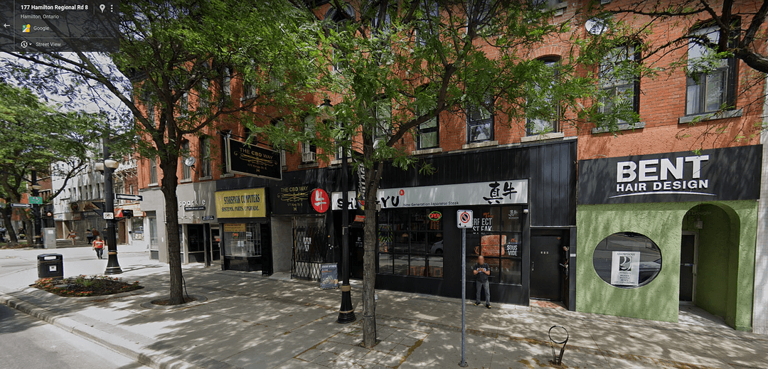
King Street East in Hamilton, Ontario
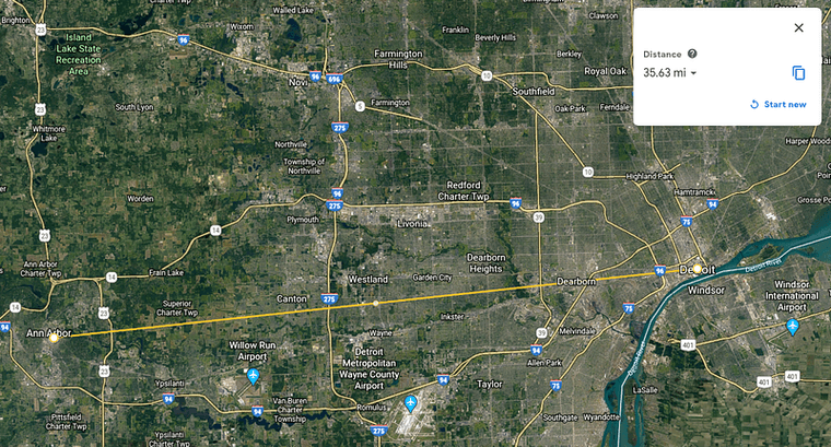
Hamilton is a city about 35 miles southwest of Toronto. If you’ve ever driven through Canada to get to Niagara Falls from Michigan, you’ve driven around this city.
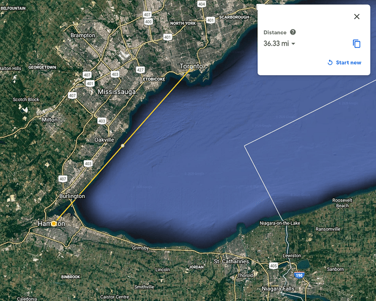
For reference, that’s about the same as the distance between Detroit and Ann Arbor.
This also confirms that bus is a prop since Hamilton Street Railway buses have a yellow stripe. So, transportation clues are not to be trusted.
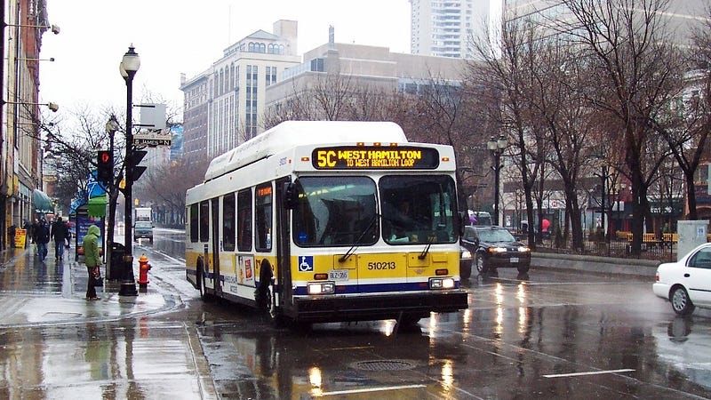
By Adam E. Moreira, CC BY-SA 3.0 us, https://commons.wikimedia.org/w/index.php?curid=4047831
Dodge flags down a bus to try to escape his pursuers. An interesting aside: The showrunners invented their own logo for Detroit transportation, likely to avoid any rights issues.
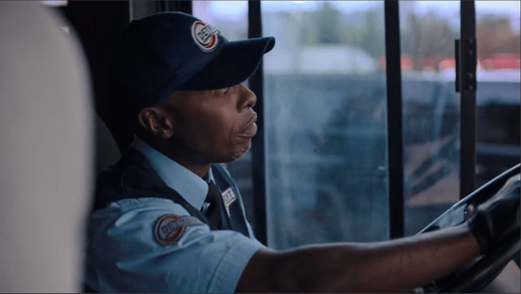
The logo in the show, a fictional red swirl.
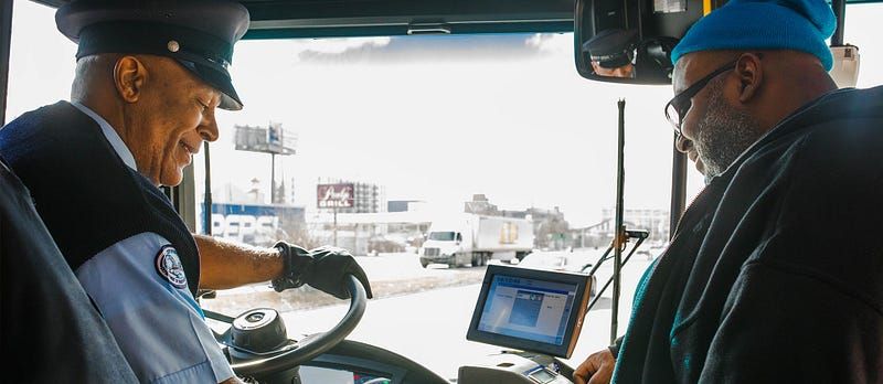

The real uniform and logo. Source: Detroit Department of Transportation
A commotion ensues as Dodge believes one of the hunters is onboard with him, and he ends up bailing. Apparently this was an international route because now we’re back near State Street in Detroit, barreling down the sidewalk underneath the parking structure for The Griswold.
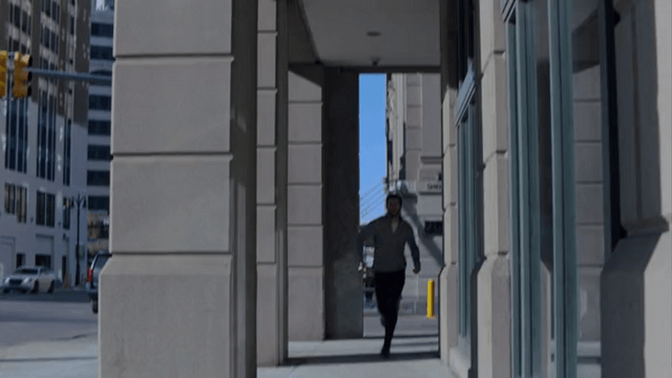
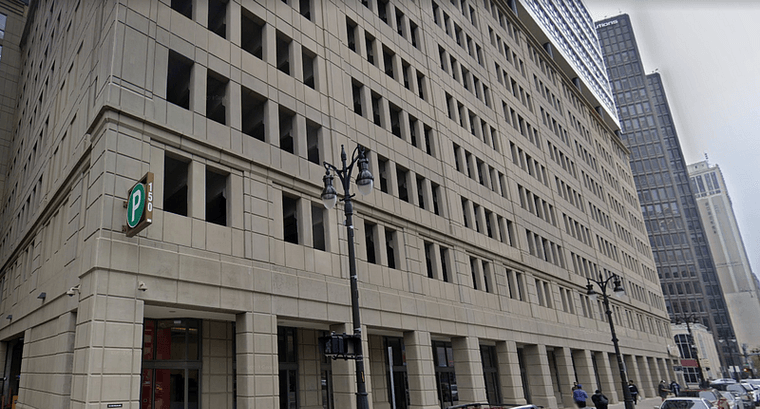
Street View of The Griswold.
There’s a scene back at Dodge’s house where his wife starts to realize something is wrong. Then, we cut to Miles’s true evil office: The command center for the hunt.
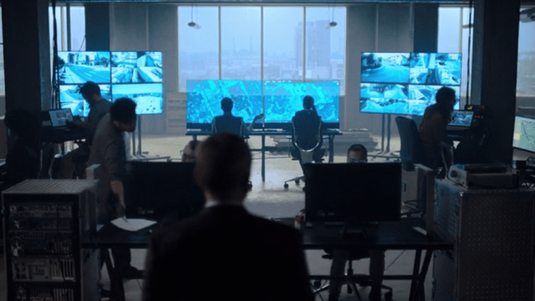
There are maps on these screens supposedly tracking Dodge and all of the hunters. The screens show up in multiple episodes.
I value my sanity, so I’m not going to scrutinize all these maps. Just certain ones.
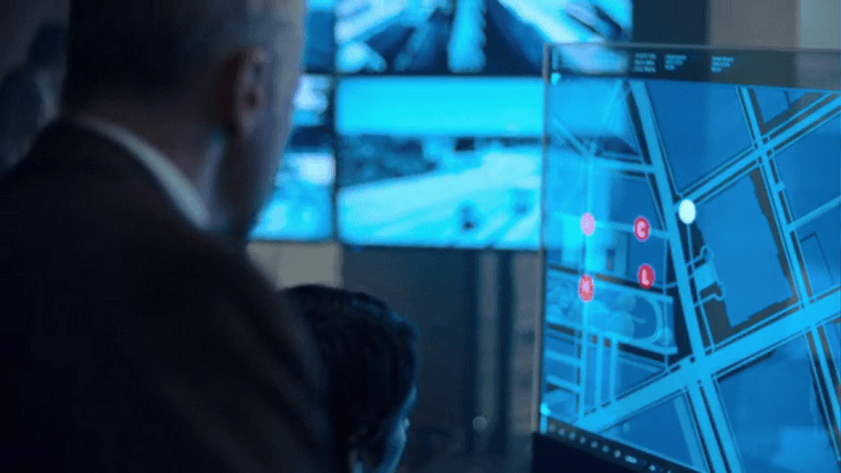
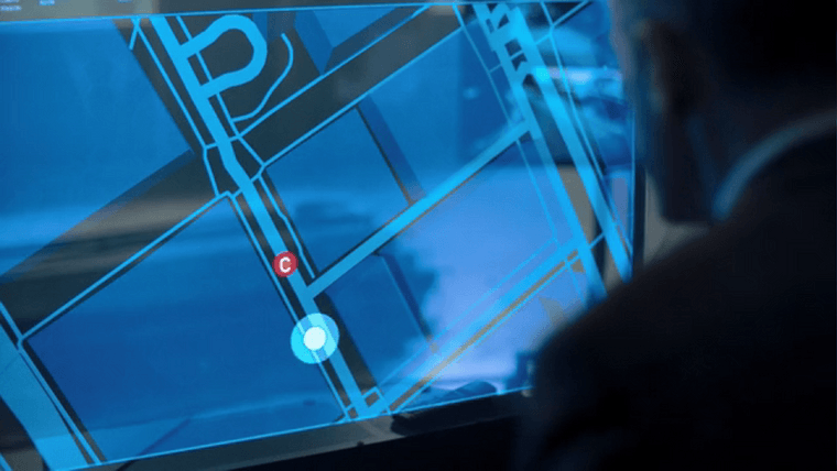
Capitol Park, supposedly, in secret spy mode
In the last moments of the episode, we see a hunter closing in on Dodge by car.
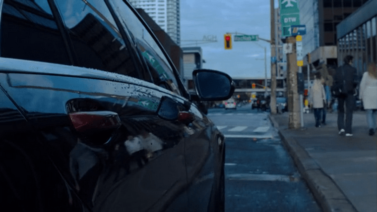
Here’s one of the tiny edits for continuity that cracks me up. This is a Hamilton shot, as made clear by MacNab Street and the “AGH” signpost near the traffic light for the Art Gallery of Hamilton. But see that airport sign in the top right corner that says “DTW”? That’s the code for Detroit’s airport, put there to cover up the fact that in real life, “Hamilton” is plainly written on that sign.
Guess that one was a little too obvious.
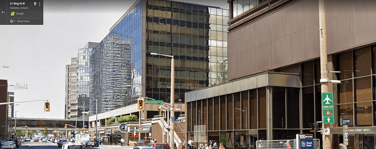
Street View of King and MacNab in Hamilton.
Episode 6: Wash Hands After Using
Dodge escapes the car in pursuit, then “turns a corner” and ends up on Jefferson Avenue in downtown Detroit.
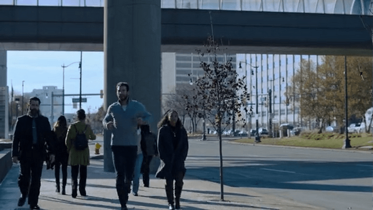
He remembers a piece of advice Miles gave him: “Crowds are your friend.” This leads him through the lower levels of the Renaissance Center…
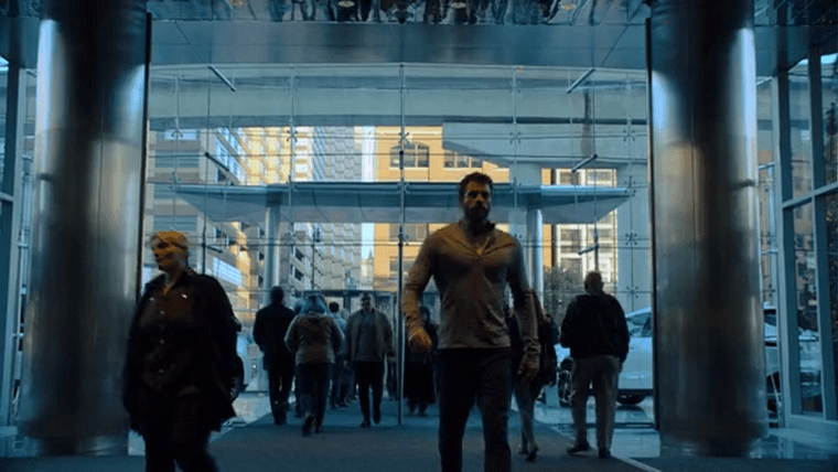
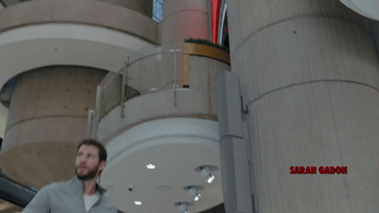
…until he climbs a flight of stairs and ends up somewhere else entirely, where he spends the rest of the episode.
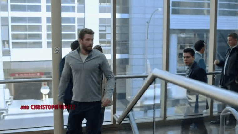
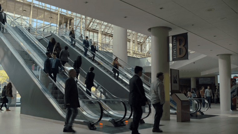
This is the Metro Toronto Convention Centre, and we’ll spend this episode and the next ping-ponging between shots filmed here and in the actual RenCen.
Episode 7: No Running on the Platform
This is probably my favorite of the episodes. Dodge escapes one of the hunters down a staircase, emerges in the lower level of the RenCen, and tries to hide amongst the tourists and workers.
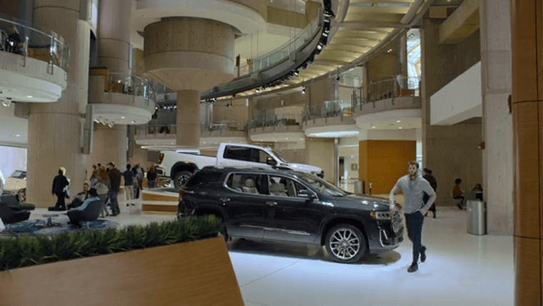
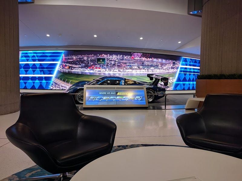
Those black chairs to the left are very comfy, and that table has charging ports for computers. Image from October 2018
Another hunter corners Dodge, and attempts to walk him out of the building at knifepoint.
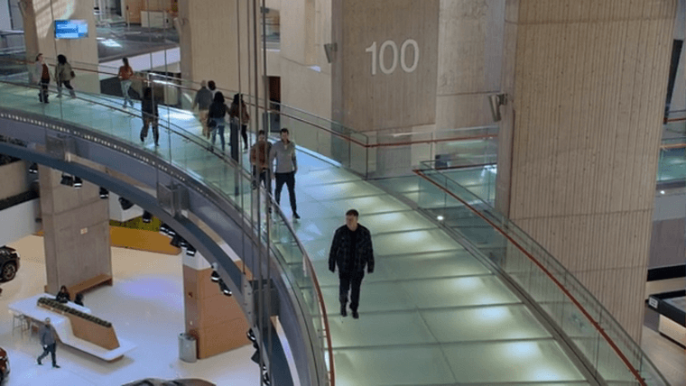
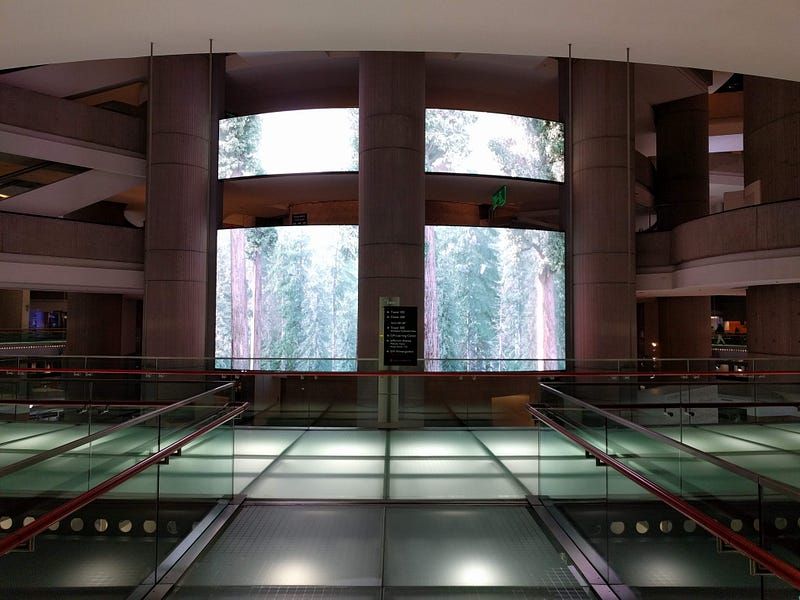
The Circulation Ring in the RenCen, which connects the complex’s multiple skyscrapers.
Then we jump back to the MTCC for the rest of the sequence, until Dodge manages to escape once again.
He races down another street. For a split second we’re back in Detroit in an alleyway behind Sid Gold’s Request Room, a piano bar near Broadway and John R.
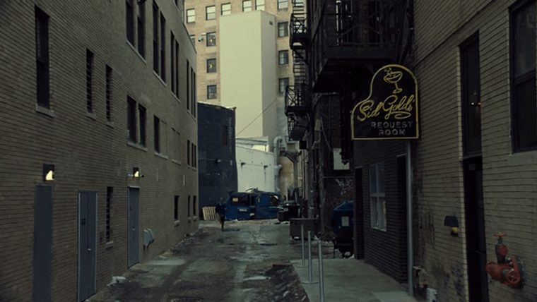
Sid Gold’s Request Room in Detroit
Then we’re back in Toronto where Dodge finds a way to escape yet again, as he does.
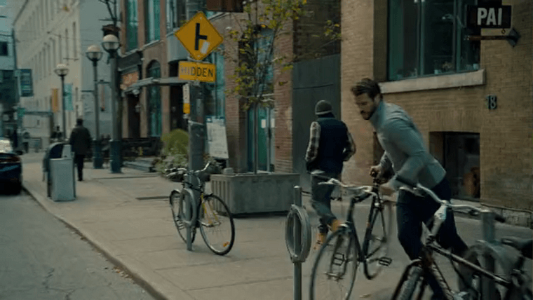
“PAI” gives this location away: That’s a Thai restaurant on Duncan Street.
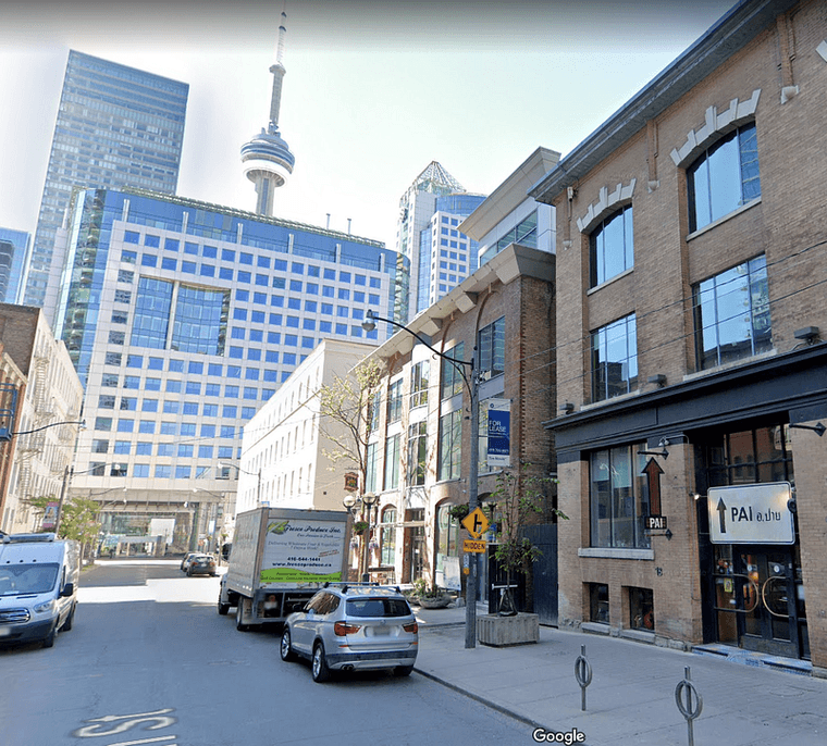
Duncan Street in Toronto, looking south.
An interesting note: There are blue banners for a “Detroit Music Festival” very briefly seen in this shot. They’re nearly unreadable regardless of resolution, so kudos to the set designers for putting that small detail in anyway. The closest thing we have to a “Detroit Music Festival” is Movement or Detroit Music Weekend .
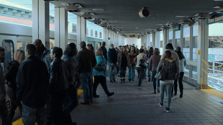
Dodge turns another magical corner and finds himself on Broadway Avenue in Detroit chasing the People Mover , our downtown circulator train…
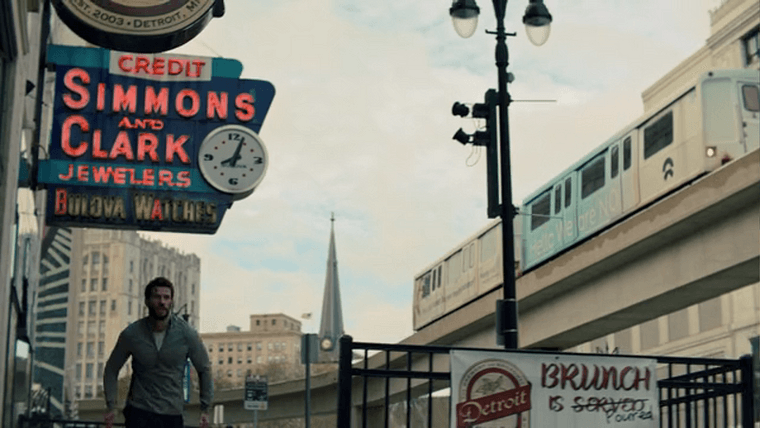
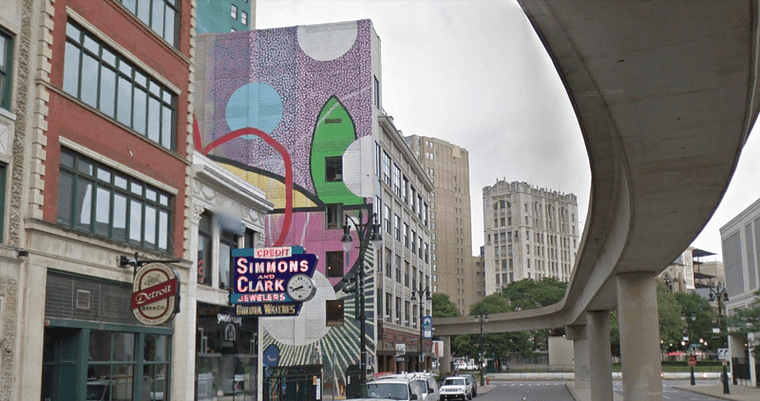
…then jumps the turnstiles at Times Square Station to board, which, while only about a 3–5 minute run, is twelve stations ahead of where the People Mover was in the previous shot (as it was running clockwise at the time). There’s only thirteen on the whole loop.
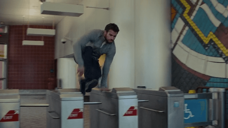
And he gets on the same train. There are usually three out on the loop at once, so if Dodge did run straight to this station from Broadway, he would’ve had to let at least one train pass to board the same one he saw earlier.
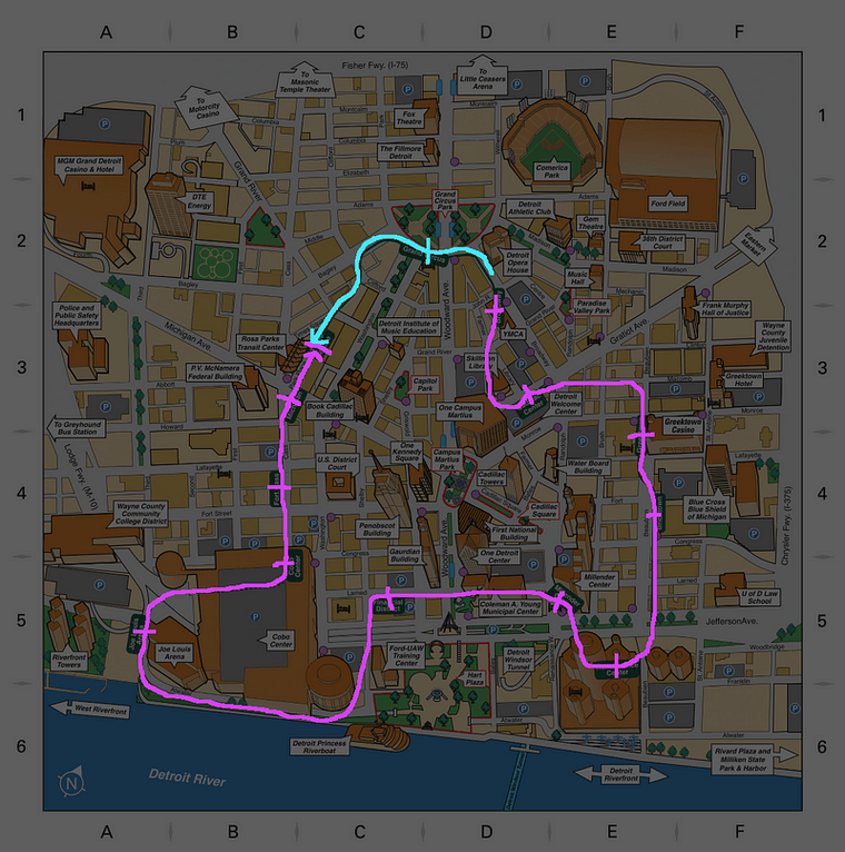
Blue line is Dodge, purple line is the train. Dodge, this is why you keep getting caught.
The editors added in an overhead announcement for immersion, but got it wrong: Fort/Cass is a station, but from Times Square the next stop would either be Michigan Avenue or Grand Circus, depending on direction of travel. Fort/Cass is at best two stops away.
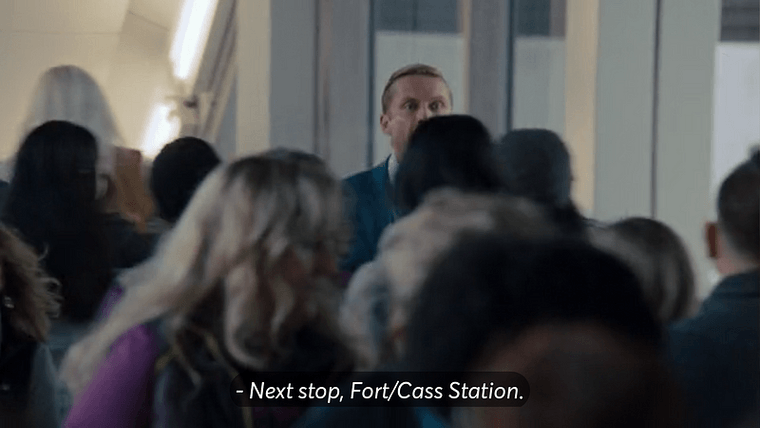
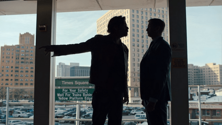
If you’re gonna add details, you gotta do it right.
Dodge rides off, leaving his pursuer on the platform.
My own footage of the People Mover departing Times Square station in February 2020.
Episode 8: Please Whisper in Church
The entirety of this episode takes place inside a bank set in what’s likely a Toronto skyscraper, Dodge’s house, and a church…
Episode 9: Return Tools to Their Place
…the exterior of which is revealed in this shot.
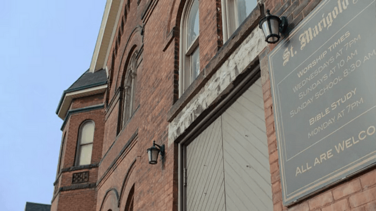
A hunter calls the church St. Jerome’s, a fictional name, but the sign says St. Marigold’s, which is also not a real church.
Remember back when I said to make note of the signage font? Same font here. The set designers put that sign there to cover up the actual name. (As for why the internal naming is inconsistent, that’s beyond me.
To find this building, I had to get creative. To start I knew we were likely in Hamilton near the King Street filming location, as Dodge sees the same car that was following him earlier.
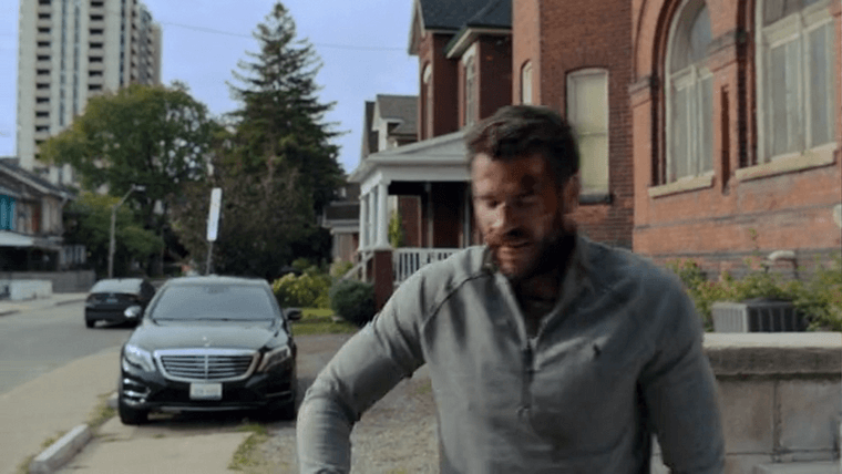
Searching for “church” didn’t turn up a match. But see the skyscraper to the left?
By this point I’d spent some time exploring downtown Hamilton in Google Earth, so I recognized it. It’s St. John Place, a building off King about a half mile east of where we were earlier.
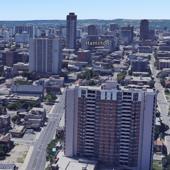
Google Earth satellite image of downtown Hamilton
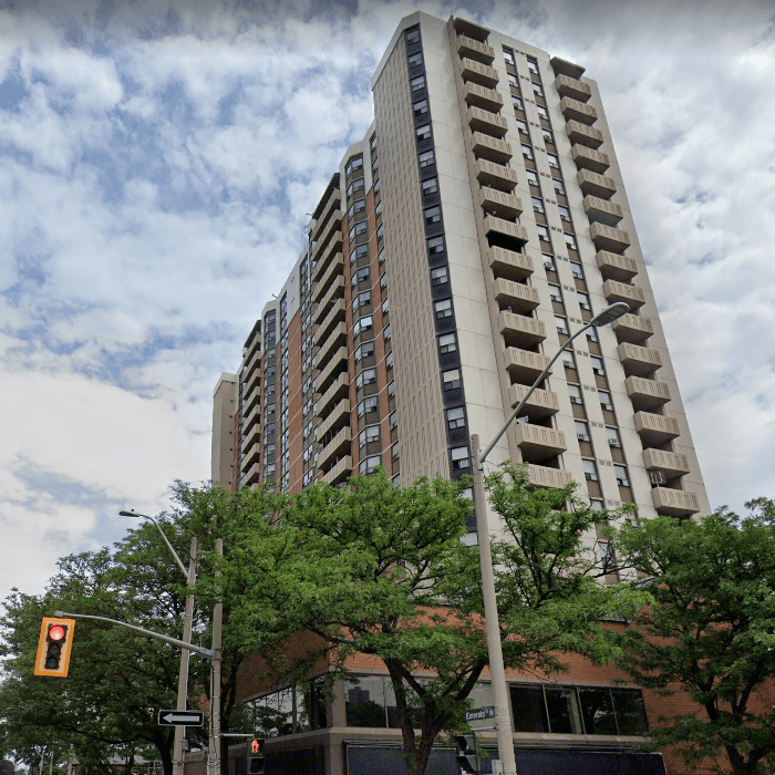
St. John Place
We’re seeing either the north or south side, so I headed south on Tisdale, the next street to the east, and north on Emerald, the next street to the west.
I found the church a block north at Emerald and Wilson. It’s the Revival Centre.
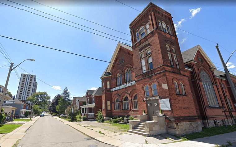
The Revival Centre in Hamilton
This also confirms that, at least sometimes, the control room maps are fudged.
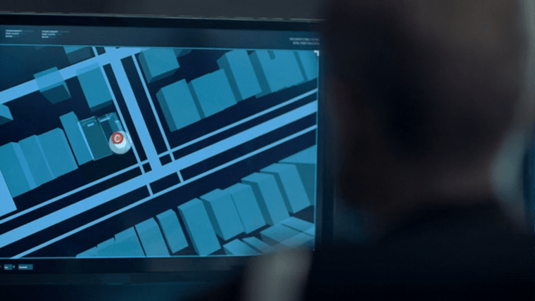
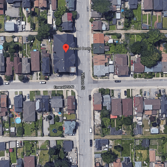
Doesn’t look like a three-way intersection to me.
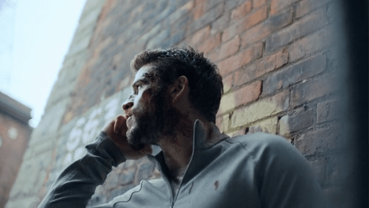
Dodge sustains wounds, and limps to an alleyway to tend to them. We briefly see “663” painted on a brick wall. 663 King Street, a few more blocks east, is a match.
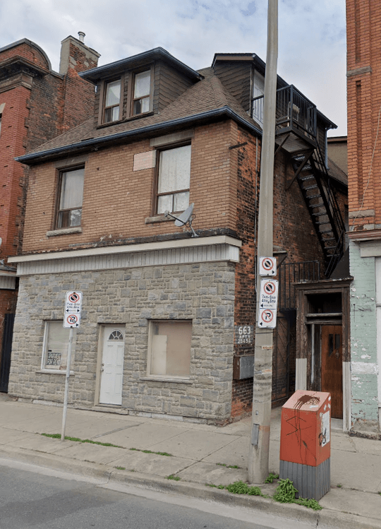
Episode 10: Five for Fighting
In this episode, Dodge blends into a Wings crowd at Little Caesars Arena.
Or at least, we’re supposed to think so.
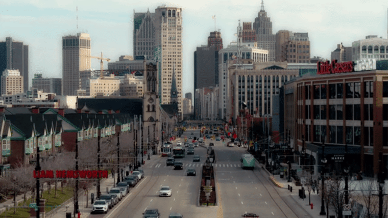
The only aerial shot of Woodward Avenue, Detroit’s main corridor, in the show
At the start of the episode, a hunter notes that he’s been heading “closer to downtown.”
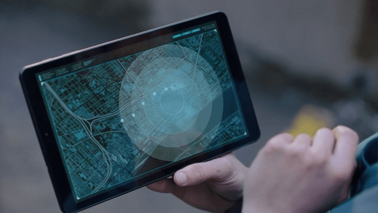
A secret-spy map of the downtown area
First off, this is an improvement: That’s actually a street map of Detroit, and one with a lot of detail.
What happened here is the actor tapped out a path that made it look like Dodge was approaching the hockey arena, and the vis team just added effects where his finger landed. Even if it’s just for show, I’ll have fun with it.
According to this, Dodge was tracked at:
- Dazelle and Wabash, just east of Michigan Central Station in Corktown, at 11:46am: labeled as “Michigan Avenue” (not far off)
- Michigan Avenue and 11th, on the bricks, at 12:46pm: labeled as “3rd Ave” (nope)
- An empty lot at Michigan and 8th, behind McShane’s and Nemo’s, at 1:46pm: labeled as “Cass Ave” (still no)
- Literally inside the MGM Grand parking garage at 2:46pm: hard to read, but label looks like “Park Ave” (nope, that’s right at the arena)
- Grand River and Elizabeth Street near Beacon Park at 3:46pm: labeled as “West Elizabeth St” (hey they got one right)
This hunter is tracking Dodge’s approach from atop the Griswold parking deck at Griswold and Grand River. The brown building is the Detroit Institute of Music.
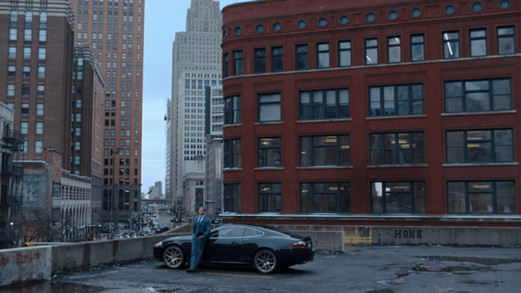
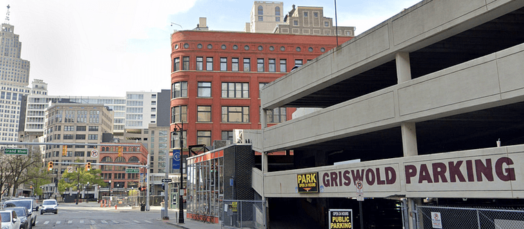
Griswold Parking Garage
But then, Miles says where the hunter is… and says a different place!
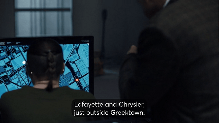
THIS map actually matches what Miles is saying, but both are wrong?!
(And a local tip, Miles: While you’re not wrong, nobody calls it “Chrysler.” It’s just the I-75 service drive.)
So, Miles blends into a crowd of Red Wings fans. But we aren’t at Little Caesars Arena, we’re somewhere else.
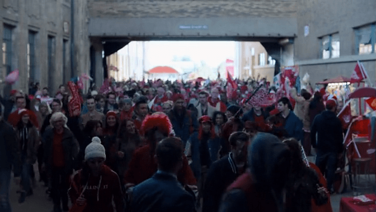
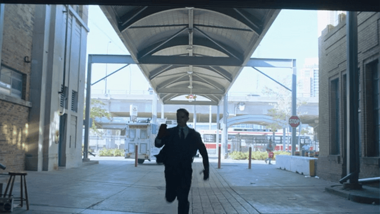
Once again, we’ve got a lucky major transit clue. Unlike previous scenes the bus in this shot is incidental and has no role in the plot, so it’s real. That’s a TTC bus, so we’re definitely in Toronto, and the terminal sign says “Exhibition Loop,” which makes things super easy: we’re at Exhibition Place.
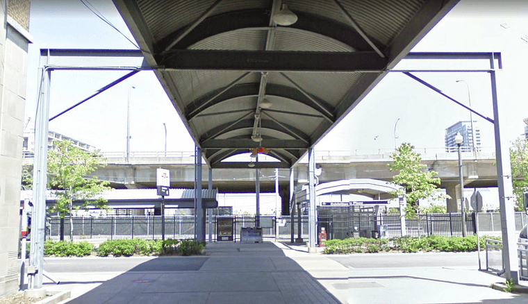
Pedestrian walkway to Exhibition Place from the bus station
The Maple Leafs play here at the Coca-Cola Coliseum, so we’re still at a hockey arena — just a rival team’s home base instead of our own.
Bonus shot: Remember way back in episode 2 where we couldn’t pin down that bar? They cut back to Dodge’s friend in this episode, and a new angle helps us out.
An address and a streetfront sign, my two favorite things.
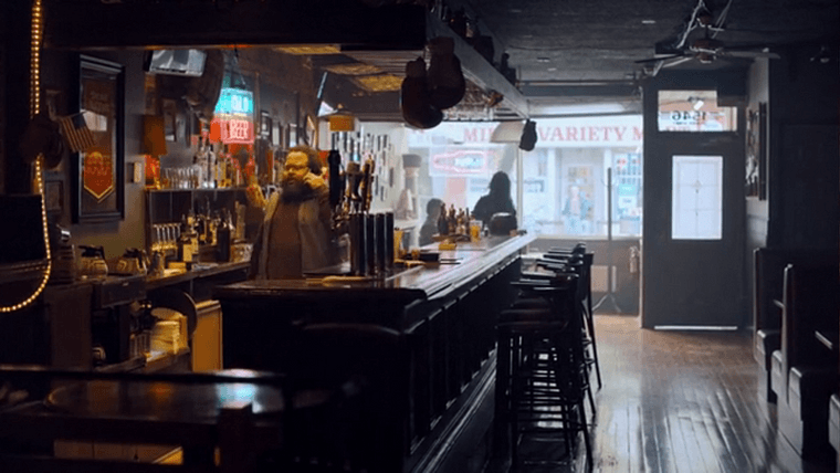
Looger’s building number is 1546.
A search brings up The Mezz on Queen Street, and it’s a match. Milk and Variety shop across from the bar, and a streetcar line out front.
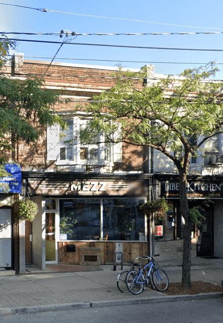
Exterior of The Mezz.
In the last minute of the episode, Dodge stows away in the trunk of a departing family’s car, but realizes he’s made a grave mistake as they’re heading out of the city.
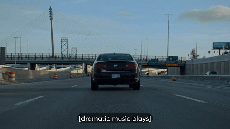
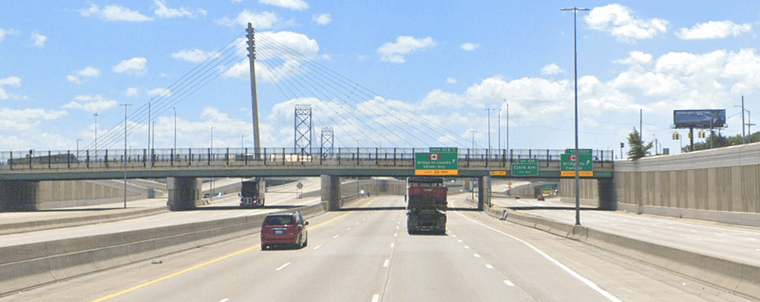
Me whenever I approach this exit in real life: [dramatic music plays]
Don’t have to look this one up, that’s I-75 South in Detroit heading towards the Ambassador Bridge. This is a nerve-wracking exit: take that off-ramp to the far right, and you’re on the bridge to Canada whether you meant to be or not with no way to turn around. The yellow text says “NO RE-ENTRY TO USA” and it is not joking.
Here though, it would seem that Dodge is in the clear as these hockey fans aren’t heading for the bridge. Guess he won’t be going on an adventure in Canada after all.
…Oh wait.
Episode 11: You Always Remember Your First
The first few frames of this episode are a drone shot of a highway interchange. They almost fooled me with this one, but that’s not the Detroit River. We don’t have any junctions set up like this with a channel of water flowing underneath.
I’m not sure where this interchange is. If I were to hazard a guess, I’d say it’s the Gardiner and Don Valley interchange in Toronto, since we end up in this area later.
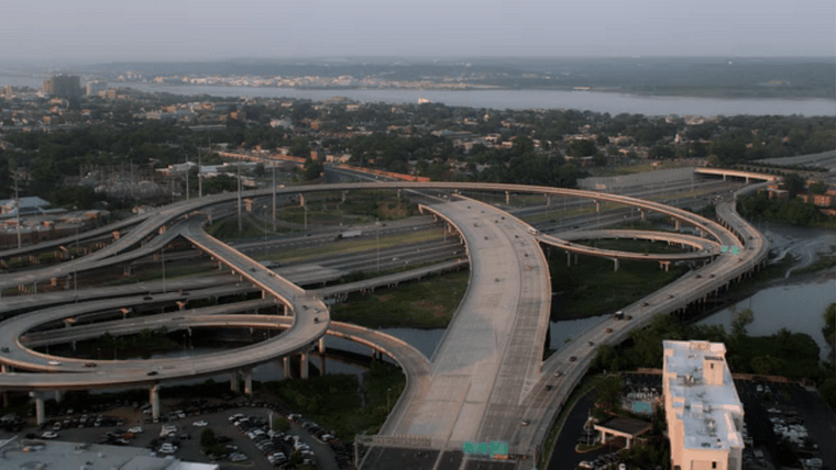
We learn the family is heading back to Birmingham, and I’m assuming they mean the suburb 15 miles northwest of downtown Detroit. It would make sense with the route they’re taking: I-75 North towards Flint.
Except, for some reason, they faked that sign.
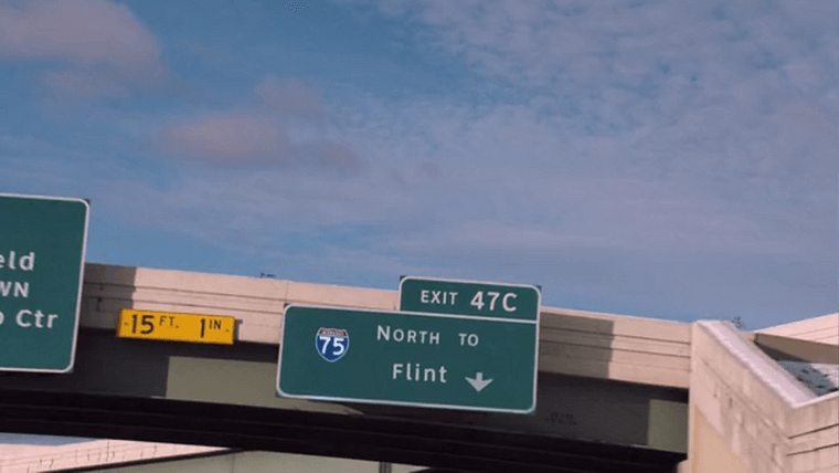
It’s another weird change made in post. I’ve been on this stretch of road, so I know that sign to the left says “Southfield/DOWNTOWN/Civic-Cobo Ctr”, which means we’re headed towards the city center, not away from it. Exit 47C is for Vernor Highway. They’re already on I-75 North.
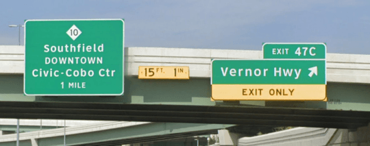
Why?
Guess the editors just wanted to make it clear he’s heading out of the city. But let’s have a little fun with continuity: We were heading south on 75 two seconds ago, so the only way this family traveled between these two points if if they did an about-face at Fort Street.
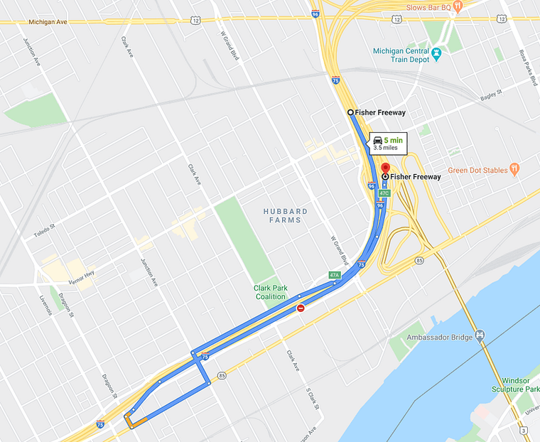
This family is lost.
And then, when they hear Dodge making noise inside the trunk, they pull off the road at exit 47A, which means they looped.
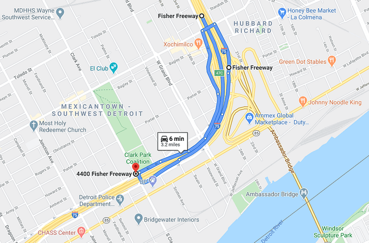
You guys just drove in a circle.
Anyway.
We then have a scene beneath a nondescript highway overpass (on 6 mile, according to the characters, but that’s way north at exit 57).
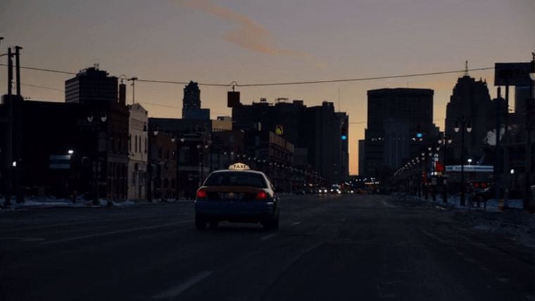
Dodge steals a cab from a Pioneer gas station, a Canadian chain, followed by a cool shot of him driving down Michigan Avenue back towards downtown Detroit.
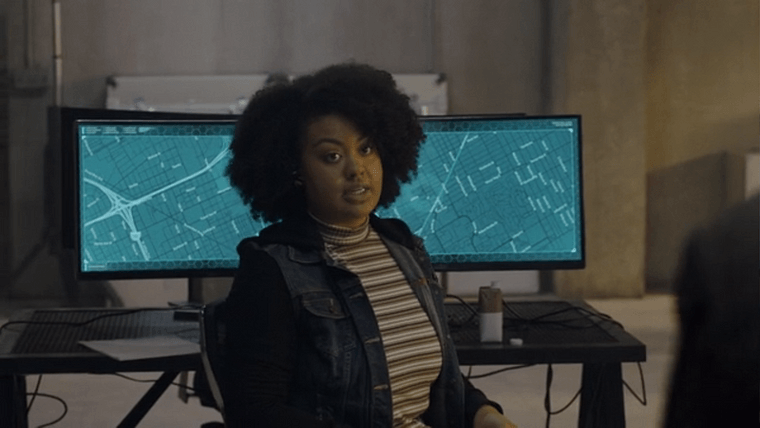
We catch a glimpse of Dodge on a (again, impressively detailed) control room map, heading towards his house. Looks like the in-show location of his house is on St. Aubin north of Gratiot.
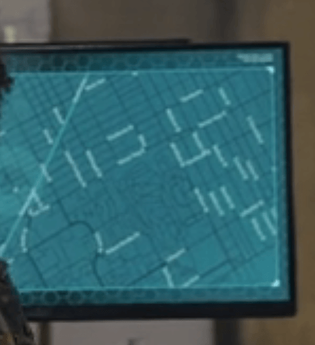
Now we’re into the night hours of the hunt, so location spotting is more difficult from here on out.
From his home, we’re led on a high-speed car chase. Brief flashes of a few streetnames are visible, including a Don Roadway. That puts us in the Port Lands of Toronto.
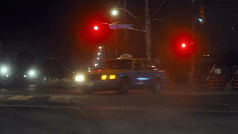
Don Roadway sign
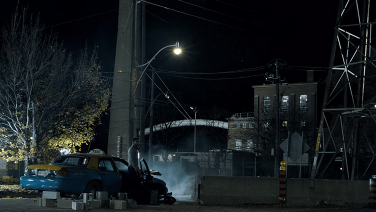
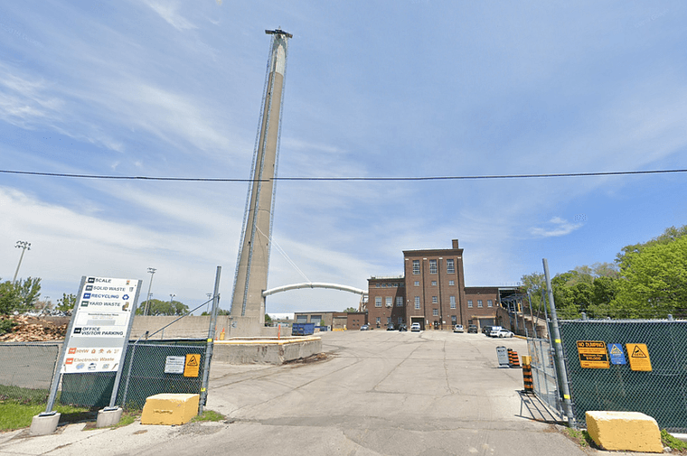
The final shot of the episode features the Commissioners Street Transfer Station as a backdrop.
Episode 12: A Ship is Safe Only in Port
This episode takes place on the Detroit Princess — or rather, a yacht that stands in for the real thing (which if we’re being honest is a bit of a downgrade from a steamboat, isn’t it?)
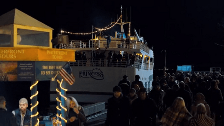
The Detroit Princess River-Yacht
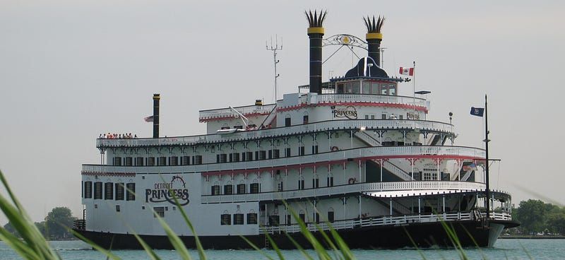
The real Detroit Princess. Source: Detroit Princess
We’re along the Waterfront Trail in downtown Toronto, with some added decor.
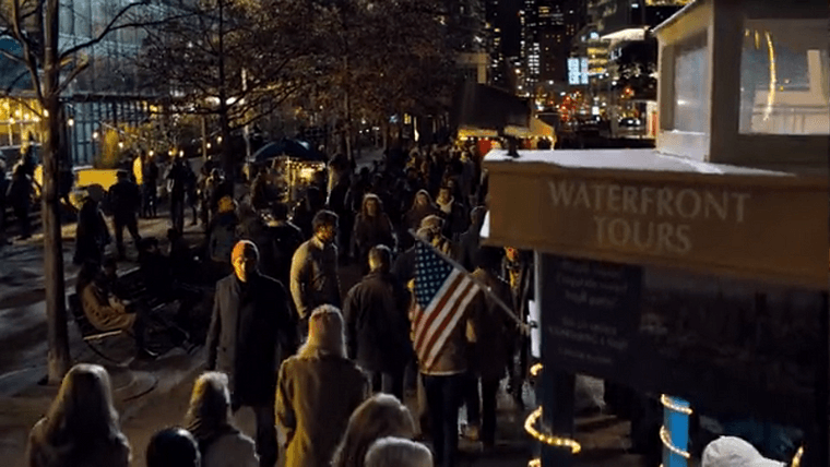

A fight at sea ensues, but Dodge makes it ashore. We see him running along King Street in Hamilton again…
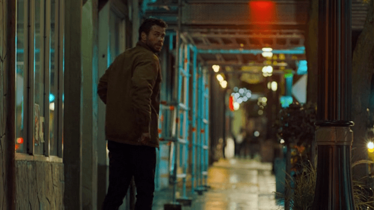
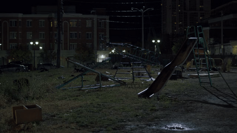
…before reaching an older neighborhood. My best guess is this is also in the Hamilton area; the broken playground equipment could be props.
Episode 13: Always Get a Second Opinion
Dodge is confronted in this neighborhood, which results in a shootout. The exterior shots are too dark to make out any useful details.
We also return to the hospital from episode 3, but any signage that would give away location has been blurred or covered up. It’s very unlikely they used a real hospital for the scenes, so there’s not much to go on.
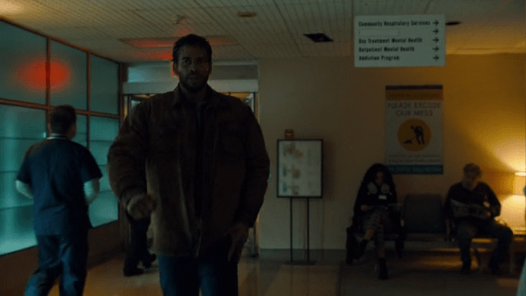
A hospital waiting area, with directional signage blurred or covered up
Episode 14: What’s Old is New Again
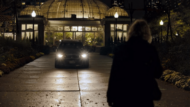
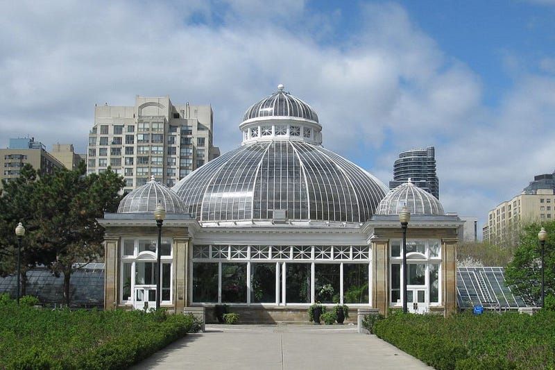
There’s one quick new location in this episode: Allan Gardens Conservatory in Toronto.
Episode 15: Game Over
This episode is an extended battle between Dodge and every hunter inside Van Buren Motors. There’s no distinct location clues as it takes place almost entirely inside a warehouse.
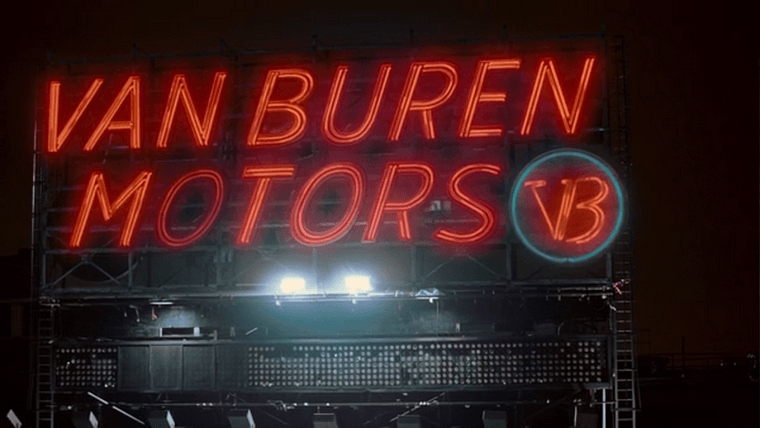
The CGI logo for Van Buren Motors.
At the very end of the episode, the characters return to the top of the Carrington for one final clash. Dodge is saved by the bell as the sun rises and the hunt ends.
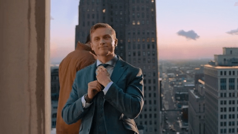
The same Detroit skyline viewpoint as earlier, this time at sunrise.
The final shot of the series shows Miles leaving the city to find the next runner for his game. And of course, we’re ending on one final “Why’d they do that?”
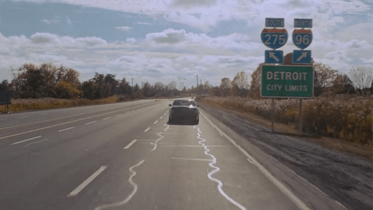
Ah yes, North 96.
This is probably some stretch of highway in Ontario between Toronto and Hamilton somewhere. The sign is completely CGI, and it’s pretty bad this time.
You won’t find a rural highway landscape like this anywhere near the Detroit city limits. In the case of the 275/96 junction, it’s quite the opposite. It’s such a poorly designed mess that it’s one of two interchanges locals have taken to calling the “mixing bowl" .
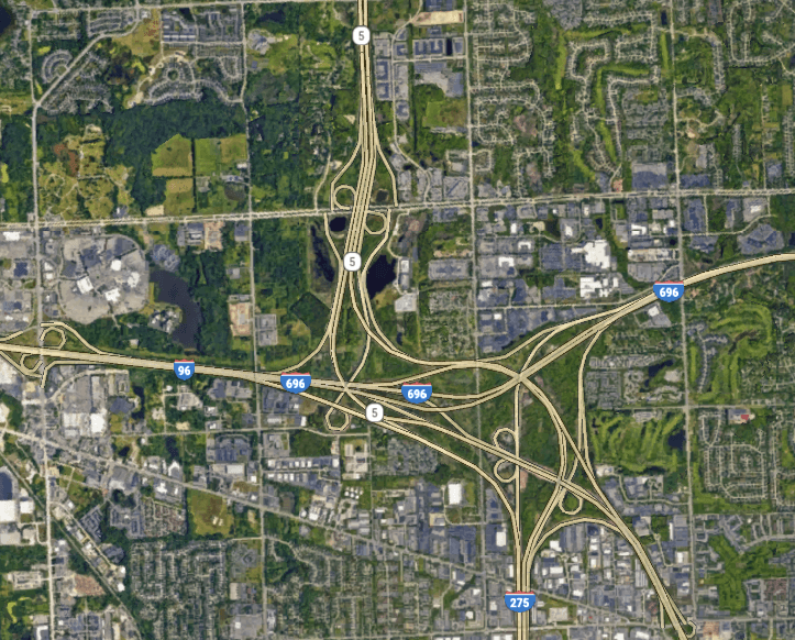
The real 275/96/696/M-5 interchange in Metro Detroit.
Not to mention they went to the trouble of getting the highway numbers right but then invented “North 96,” which doesn’t exist.
Bonus Feature: Location Map
So, there it is.
Here’s a bonus for making it through this whole thing: You can explore every real-life filming location from in this article in a Google Earth map .
This article and that map are the product of fifteen days of stay-at-home summer. Have fun!